The results are in for the winners of the 2022 HCTF Conservation Lands Photo Contest!
The 2022 Habitat Conservation Trust Foundation’s Photo Contest encouraged photographers and BC residents to get out to Conservation Lands across the Province to enjoy the natural beauty British Columbia has to offer.
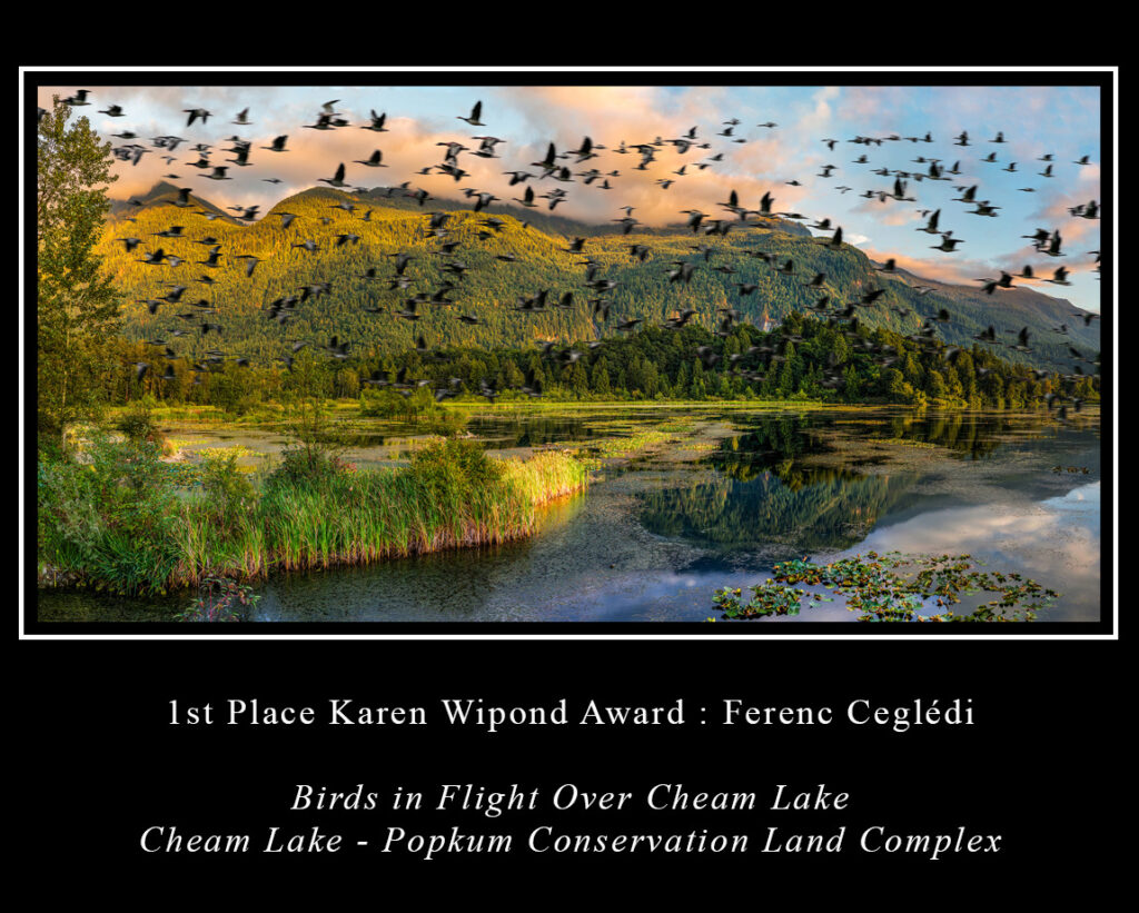
1st Prize: Karen Wipond Award
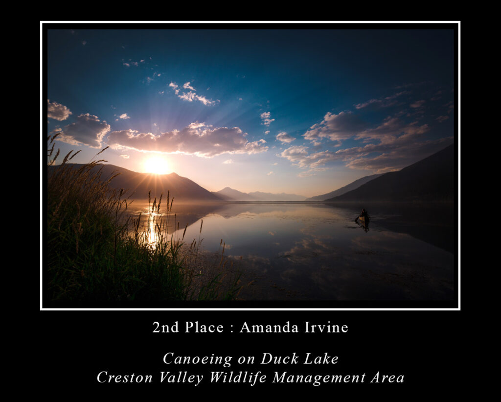
2nd Prize
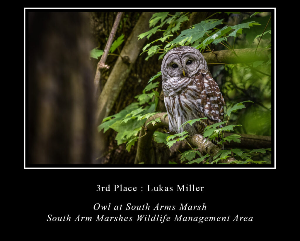
3rd Prize
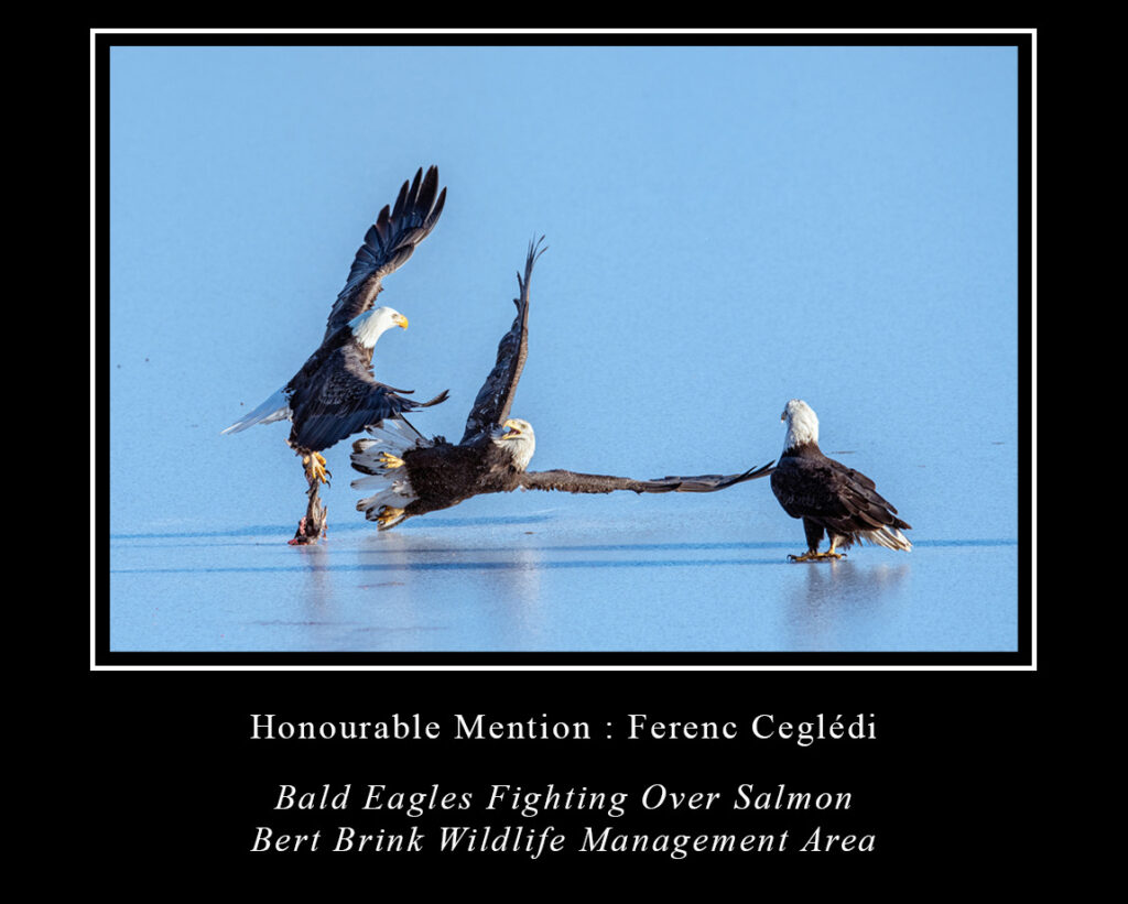
Honourable Mention
Conservation Lands
The winning photographs were taken within the boundaries of provincially administered Conservation Lands in the province of British Columbia (see map below). While HCTF encourages photographers and all nature-minded individuals to explore BC’s Conservation Lands we recommend that you research the Conservation Land you intend to visit beforehand, obey all safety requirements, public access best practices, and ethical guidelines when taking pictures of wildlife (for recommended ethical wildlife photography see the Audubon Society’s Guide). Conservation Lands are protected and managed for the purposes of conserving important habitat and ecosystem functions, and it is important that visitors do their part to maintain these sites for generations to come.
The primary purpose of conservation lands is to conserve and manage important habitat for the benefit of regionally or internationally significant fish and wildlife species. This includes habitat that is vital for:
- Sensitive, vulnerable, or at-risk species.
- Critical species life-cycle phases such as spawning, rearing, nesting, or winter feeding.
- Species migration routes or other movement corridors.
- Supporting unusually high species productivity or diversity.
Conservation lands often concurrently provide for a range of opportunities for public access, including day hiking, hunting and fishing, wildlife viewing, scientific research and education, and traditional activities of First Nations.


