Thu, 29 Jun 2017

The Secret Life of Wolverines

Remote cameras provide researchers with a window into the secret life of wild wolverines. We’re finding these animals are far more social than previously thought.

When you read the word “wolverine”, what comes to mind? A snarling, snapping North-American version of the Tasmanian devil? A fearsome furball taking down prey ten times its size? Hugh Jackman?

For a creature whose reputation has reached mythical proportions, it might surprise you to learn that there’s still a lot we don’t know about wolverines. Naturally rare, wolverines are found in remote wilderness areas, making them challenging study subjects. But with increasing pressure on the landscapes that wolverines and other wildlife call home, it’s more important than ever for land managers to have accurate information on wolverine populations in BC. Advances in research techniques and technology are not only providing the data necessary to protect wolverines, they’re actually changing the way we view this elusive species.

Cliff Nietvelt is a BC government wildlife biologist who has been studying wolverines since 2009. It was that year, working on a collaring project in the North Cascades, that he had his first up-close encounter with a wolverine. “We had set up a box trap and caught other carnivores but had no luck getting any wolverines,” recalls Cliff. “I’d actually gone out to close the trap for a few days when I noticed a wolverine track. I tapped on the top of the box and heard this low, guttural growl, the kind that makes the hair stand up on the back of your neck.” The wolverine – nicknamed “Rocky”- was fitted with a satellite collar and sent on his way to collect information about the species’ habitat use and range.

Now, Cliff has just completed another wolverine conservation project supported by the Province and the Habitat Conservation Trust Foundation. Using a combination of remote cameras and genetic analysis, the project examined how wolverine distribution and density could be affected by factors such as human disturbance. This question is of particular importance in the South Coast region of BC – a paradox of development and wilderness.

“Here, we have the bulk of BC’s human population and Canada’s third largest metropolitan centre adjacent to this really rugged terrain that’s home to grizzly bears, mountain goats, wolverines – all species with big space requirements,” says Cliff. “It’s good habitat for the most part, but it’s becoming more and more fragmented by roads and human habitation.”
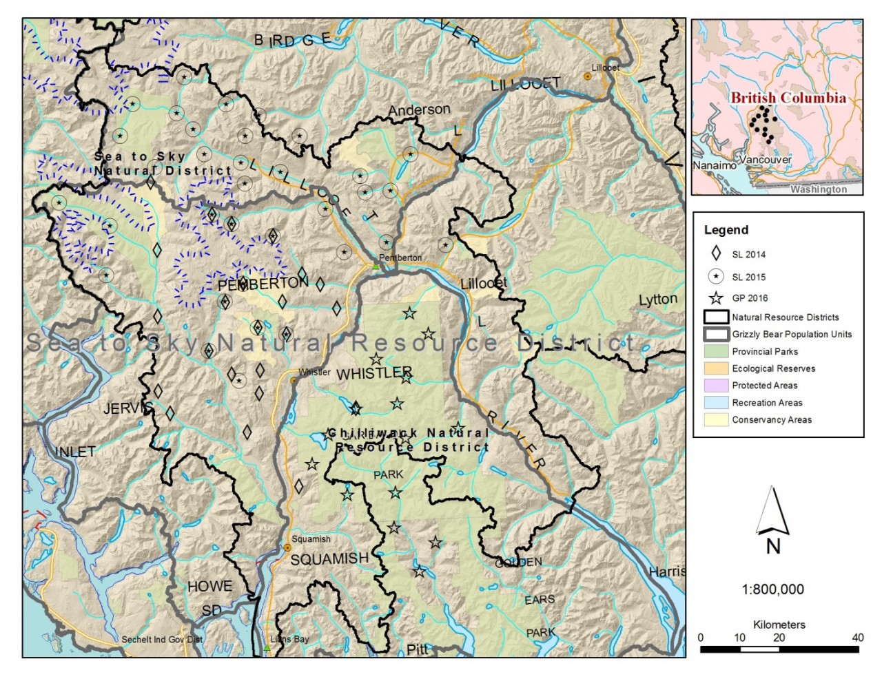
Cliff and his team set up over 70 data collection sites in the South Coast’s Sea-to-Sky District. Each site was equipped with a remote camera, a run-pole and specially-designed hair snaggers made from alligator clips and barbed wire. The setup was based on research done in Alberta and Alaska, but the BC team had to customize some of their techniques to meet the unique challenges posed by West Coast weather.

To attract wolverines to the site, they started with a “lure”: a tantalizing mix of beaver castoreum, marten or fisher musk, and essence of skunk. “We mix it all up in a 2L milk jug with a glycerin base,” explains Cliff. “It’s pungent at first, but it loses its potency fairly quickly in wet conditions.” To offset this, the team had to bring in an extra ingredient tolerated by only the toughest of researchers: rotten cattle blood.

“The cattle blood was primarily used for grizzly bear DNA stations and sourced from a local abattoir. We have to keep it at the local dump, where it’s stored in barrels, baking in the sun. After a few months, it gets quite the bouquet on it. Ninety-nine percent of people who’ve experienced it vow never to touch the stuff again,” shares Cliff. “We splash it on the trees in the periphery and it mimics a kill site or rotting carrion. Even a couple of weeks later, the scent of blood will still be in the air. It draws the animals close enough to spot the bait. We primarily use beaver meat, as we can source it from local trappers. But we’ll also use road-killed moose, elk and deer when we can get it.”

Like the lure, Cliff’s description of bait preparation is not for the squeamish. “We have to freeze it solid first so we can easily cut it up with a chainsaw, and we need to be able to drill through bone to hang it at the site. Otherwise, an animal can rip it off pretty quickly.” If the bait disappears, Cliff says it doesn’t take long for the animals to stop coming, and this impacts the effectiveness of the study. “You risk underestimating what’s out there. To mitigate this, we hang a cattle femur at each site, as it serves as a visual attractant and wolverines can also break the bone to access to marrow. If there’s at least a bone still hanging, you’ll still get wolverines coming to check it out and chew on it.”
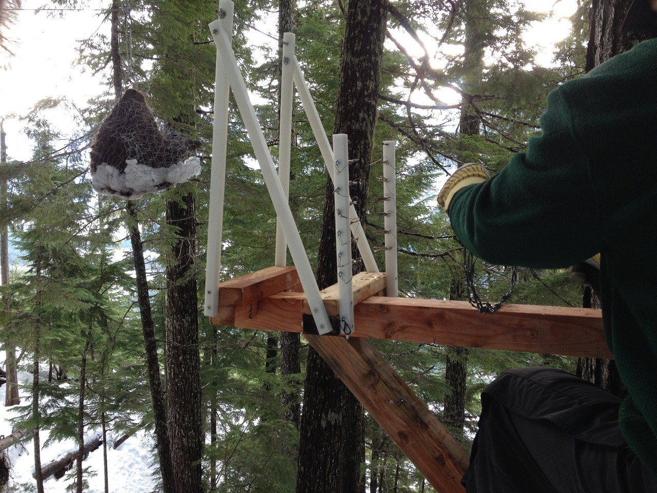
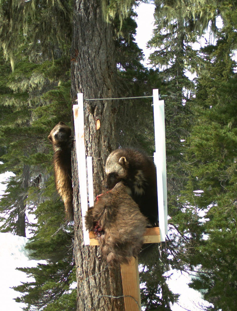
To reach the bait, wolverines make their way across the run-pole, a platform of sorts constructed from two 4x4s braced to a tree. At the end of the 4x4s is a reinforced plastic frame attached to a 2×4 cross piece, and behind this are two plastic rods with a carefully arranged series of alligator clips with jaws open in wait. As the wolverine vigorously attempts to take down the bait, they knock the alligator clips shut and leave a hair sample behind. This technique works well for matching a wolverine caught on camera with its DNA from the hair sample, but an additional modification had to be made after the team found they had multiple wolverine visitors. “The disadvantage of the alligator clips is that they usually only collect hair from one animal, so if there are three or four wolverines in a sampling session, you’re not collecting the hair from all of them,” explains Cliff. “So we found a way to add barbed wire to the tree and run-pole. We’ve really refined it to the point that we’re getting much better samples from the wire than the alligator clips.’”
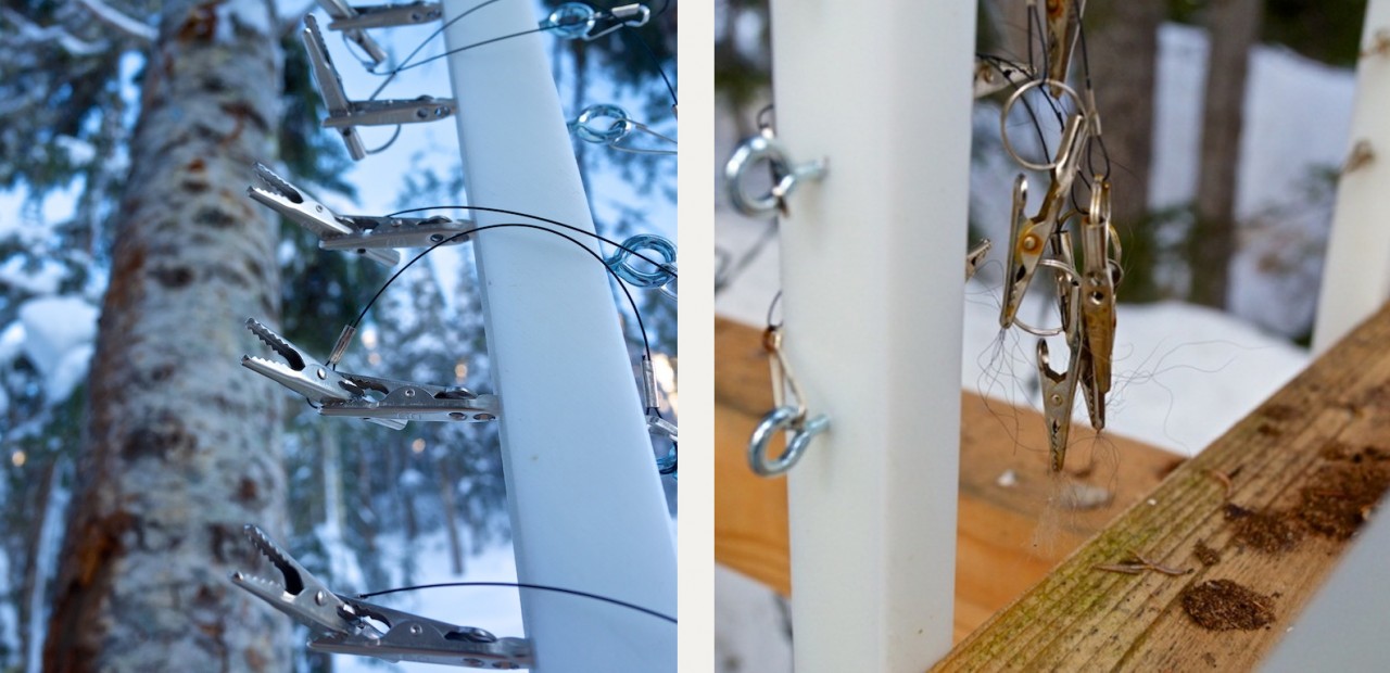
In total, Cliff’s study collected 1,560 hair samples in the Squamish-Lillooet and Garibaldi-Pitt regions. The DNA from these samples was analyzed in the lab and determined to belong to 36 different wolverines (20 males and 16 females), and as many as 45 wolverines were identified visually. While the number of individuals was higher than expected, it was the degree of genetic isolation between the geographic populations that the lab described as “remarkable”. After incorporating the results of hair samples from a separate wolverine study in the Bridge area, the lab found there is almost no mixing of individuals between the 3 regions: the populations are almost completely distinct. Not only is it highly unusual to find such clear separation between populations in an area of this size, it also has important conservation implications. “Isolated populations are much more susceptible to any kind of disturbance or mortality,” says Cliff. “And if they’re wiped out, there’s a much lower chance of an area being recolonized.”

With the rapid pace of development on the South Coast, Cliff feels there’s cause for concern. “You’re dealing with a species that’s likely not as tough as we think, and maybe not as resilient as we think,” he says. “Because of the [remote] cameras, we’re getting a very different picture of wolverines.” While the cameras’ primary role in Cliff’s research is to match up an individual wolverine’s unique throat and chest markings with the genetics from the hair samples, they also act as a fantastic window into the secret world of wolverines. Multiple clips show wolverines playing and socializing with each other, and Cliff’s study has identified up to six different wolverines visiting a particular site. It would seem that wolverines (on the South Coast, anyway) are hardly the reclusive loners they’re reputed to be. The footage also shows a side of wolverines that is far more vigilant than vicious. Even when engrossed in a meal of beaver bait, the animals frequently pause to look, listen, and smell, behaving more like prey than predator. While there’s no doubt that wolverines can be fierce hunters, they are not fearless, and seem easily spooked by the presence of other predators – and humans.

“We see higher detection rates of wolverines at sites that are truly backcountry, with no human access,” explains Cliff. “Sites in the front country that are adjacent to snowmobile trails and the like have a much lower rate of detection.” Development and a reduced snowpack caused by climate change could result in increased access to areas where wolverines have traditionally lived undisturbed. Increased access could also lead to increased competition from wolves and coyotes in habitats that were formally a niche for wolverines. Neither scenario bodes well for the species.

“If you look at where wolverines are found, they are true wilderness areas,” says Cliff. “In places such as Ontario, the range of wolverines has decreased over 50% since 1850, and now they are only found in the province’s far north. In BC, we have the advantage of very rugged terrain that, thus far, has been difficult to access.” Cliff says the real importance of this research is to get a clear understanding of what factors are important to wolverine survival, so that we can work to protect them before the damage is done. The benefits are likely to go far beyond saving the South Coast’s wolverines. Cliff explains: “I have this saying: If we protect wildness, we protect wilderness. The wolverine is a species that is representative of wildness, and if we can keep species such as wolverine on the landscape, we can BC help maintain BC’s wilderness that so many British Columbians hold dear.”

You can watch a video of footage from this project here.
Mon, 19 Jun 2017

Restoration Work Begins on the Englishman River Estuary

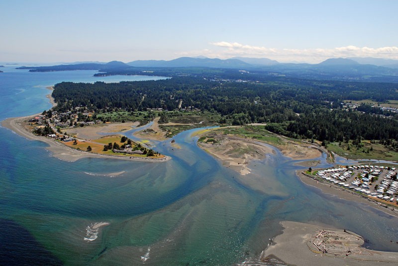
If you are walking the trails and beaches at the Englishman River estuary this summer, you may notice some new activity and heavy equipment working. It’s all part of a five-year plan to improve the habitat for fish and wildlife.

The Englishman River estuary and adjacent habitats support over 250 bird species, 23 mammals, plus several amphibians, reptiles, all species of Pacific salmon, and forage fish such as herring and Pacific sand lance. For over 25 years, The Nature Trust of British Columbia and partners have worked to secure land along the Englishman River. Today, over 100 hectares (247 acres) of the Englishman estuary and adjacent forest are protected and form part of the Parksville-Qualicum Beach Wildlife Management Area.

Since the 1930s, the Englishman estuary has been impacted by dikes, roads, residential development, industrial uses, and ditching. Today portions of the estuary are almost completely cut off from natural tidal and river processes. Consequently, the estuary has become less accessible for fish and wildlife that would normally use these habitats for shelter, feeding, and rearing.

“The Nature Trust of BC has been working with partners for decades to acquire and manage ecologically important lands along the Englishman River. It is a key river for fish and wildlife, and this habitat restoration project will have an enormous benefit for the future,” says Jasper Lament, CEO of The Nature Trust of BC.

The first step of this 5-year restoration project is to remove an old abandoned roadway on the west side of the estuary that was originally constructed in the 1960s for log booming operations. Other activities this summer will include enhancing tidal channels; increasing habitat complexity for fish and wildlife; and removing invasive plants. Funding for this project is provided by Canada’s National Wetland Conservation Fund and the Habitat Conservation Trust Foundation.

The Habitat Conservation Trust Foundation is a BC environmental granting organization that also contributed to the purchase of the conservation lands at Englishman River. Ross Peck, the Foundation’s Chair, says the work being done by The Nature Trust is essential to the survival of fish and wildlife in the watershed. “The Englishman used to be a popular spot for steelhead fishing, but like so many of the runs on southern Vancouver Island, the population collapsed in the 1990s and is now only a fraction of its historical size,” says Peck. “It’s death by a thousand cuts: the human impacts on these systems have severely affected the fish and wildlife that depend on them. We need to strongly invest in the habitat that’s left to give the fish a fighting chance.”

This project will be coordinated by the Vancouver Island Conservation Land Management Program on behalf of The Nature Trust of BC, and will also involve several partners including Fisheries and Oceans Canada, Ministry of Forests, Lands and Natural Resource Operations, BC Conservation Foundation, Mid-Vancouver Island Habitat Enhancement Society, the Arrowsmith Naturalists, and Guardians of Mid-Island Estuaries Society.

“The Englishman Estuary is critical to juvenile Pacific salmon. Juvenile Chinook, Coho, and Chum salmon may spend weeks to months growing and adapting to more saline conditions before moving offshore. Sea-run Cutthroat Trout and the iconic Winter Steelhead frequent the estuary for shorter periods, but still rely on its diverse food supply for critical growth and as an important staging area before migration up-river. This restoration project is a valuable step to fully restoring the estuary’s natural productivity and fish rearing potential,” says Craig Wightman with the BC Conservation Foundation.

As part of this restoration project, construction work involving heavy machinery will take place in the estuary for two weeks this summer. To ensure public safety, some areas and walking trails will be closed while the old roadway is being removed. Access will be restricted and we ask the public to please obey signs.

By removing an artificial human-made structure and restoring natural processes, this project will create a more natural estuary habitat which will, in turn, benefit many species of fish and wildlife.

The Vancouver Island Conservation Land Management Program is an innovative strategic partnership program involving the management of over 100 conservation areas on Vancouver Island, and the central and north coast. The partnership has been in place for over 20 years and includes Environment and Climate Change Canada (Canadian Wildlife Service), the Ministry of Forests, Lands and Natural Resource Operations, The Nature Trust of BC, and Ducks Unlimited Canada. We gratefully acknowledge funding for this project from the National Wetland Conservation Fund and the Habitat Conservation Trust Foundation.

Wed, 26 Apr 2017

Bull River Bighorn Herd Helped by Land Purchase

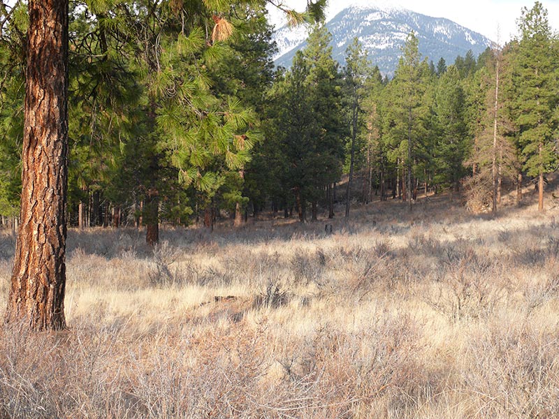
Bull River property.

The Nature Trust of BC has just announced the successful acquisition of the Bull River Grassland Corridor property in the East Kootenays.


Nature Trust CEO Jasper Lament said the 67 hectare property is an exciting addition to existing conservation lands in the lower Bull River: “Bighorn sheep use this property as part of their traditional winter range,” said Lament. “Because it is bounded on three sides by other conservation lands, it is a very strategically important acquisition.”? The securement of this property removes threats of disease transmission from domestic livestock to the Bull River bighorn sheep herd. It also protects winter range for elk and deer, and protects habitat for the provincially Redlisted American Badger. This project was completed with incredible support from the Habitat Conservation Trust Foundation, BC Conservation Foundation, Fish & Wildlife Compensation Program, and Environment and Climate Change Canada through the Natural Areas Conservation Program facilitated by the Nature Conservancy of Canada. The Habitat Conservation Trust Foundation provided over $350,000 to the purchase of this property, and is also funding a project studying the health and movements of the Bull River bighorn herd. “The Bull River herd has partially recovered from a die-off in the 1980s, and we felt it was critical that this key piece of their winter range was protected from any type of development that could be detrimental to the herd’s survival,” said HCTF CEO Brian Springinotic.

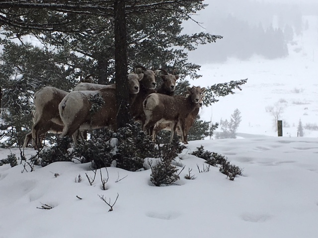
The Bull River bighorn herd in winter.

Each year, HCTF provides approximately half a million dollars to BC conservation organizations purchasing land to protect wildlife habitat. The Foundation also provides over $6M in grants annually for projects benefitting fish and wildlife in BC.

Thu, 3 Nov 2016
Tags: Education

A Summer with the Birds – Student Shares Her Experiences Working with the Delta Farmland and Wildlife Trust

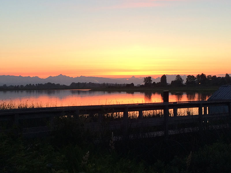
Delta-sunrise.jpg

As a follow-up to our video series on the HCTF Summer Internship Program, we received the following article from the Delta Farmland and Wildlife Trust (DFWT), written by their 2016 intern, Jennifer Sibbald. Jennifer is the third BCIT student to complete a summer internship with DFWT under this program.

Each morning, from May through July, I was up with the sunrise. It wasn’t that I had trouble sleeping or because I’m naturally an early-riser: I was there for the birds.

In spring, as migrating songbirds travel toward their food-rich breeding grounds, many stop in the productive agricultural lands of Delta, BC. This stop-over results in a flurry of morning activity, known by many as the ‘dawn chorus’. This musical cacophony is the sound of many male birds singing to attract a mate, each with their own unique song. In the birding world, these moments are the perfect time to survey birds, as one can identify them by sight as well as sound.

Delta-sunrise.jpg

Though waking at dawn may not be for everyone, it was the perfect way for me to spend a summer. As a student in the Ecological Restoration Program at British Columbia Institute of Technology (BCIT), I jumped at the offer of an internship with Delta Farmland and Wildlife Trust (DF&WT). With generous funding from Habitat Conservation Trust Foundation (HCTF), the City of Surrey, BCIT Rivers Institute, and DF&WT, an internship was created to study the richness (number of species), abundance (number of individuals) and diversity of songbirds using hedgerows planted by DF&WT in Delta, B.C.

In Europe, it is well studied and understood that hedgerows provide many ecological and economic benefits to agricultural landscapes. Hedgerows provide shade for livestock, help reduce soil erosion, give homes to beneficial pollinating insects, and provide necessary breeding habitat for many species of songbirds. DF&WT has long recognized the importance of hedgerow habitats, and has sought to create more of these areas through their ‘ Hedgerow Stewardship Program’. In recent years, DF&WT is initiating some of the first hedgerow studies that I am aware of in British Columbia, including the songbird study I was given the opportunity to be a part of.

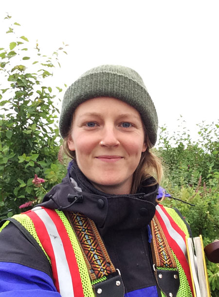
Jennifer_S_selfie.jpgIn the spring of 2015, BCIT Ecological Restoration student Arthur Kujawiak began the pilot study focusing on the abundance and diversity of songbirds using DF&WT hedgerows. In 2016, I continued the study to establish a multi-year dataset of the birds using these hedgerows. Additionally, I was empowered by DF&WT to expand the study and ask a few questions of my own. I focused my questioning on whether differences in plant composition of the hedgerows impacted bird communities.
Having been recently immersed in school and ecological theory, I knew that increases in the diversity of plant structure (e.g., different heights) and composition (e.g., different species) typically lead to the increased biodiversity of animals living in an ecosystem. I hypothesized that in hedgerows where plant diversity is greater, we would see a greater diversity of songbirds. From careful study design, data collection, and data summarizing, we found this to be true of DF&WT hedgerows. These findings support the management actions of DF&WT, which strive to plant a diversity of native trees and shrubs along their hedgerows.

After many sunrises, countless hours of data entry, and time spent just listening to the birds, I was able to provide some insight into how songbirds use hedgerows in Delta, BC. As a student, this was a fantastic opportunity ask questions of my own, independently conduct fieldwork, and learn to identify over fifty species of birds by sight and sound! Thanks to the support from DF&WT, HCTF, City of Surrey, and the BCIT Rivers Institute, I have gained invaluable experience for my future as a biologist, and had a summer I will never forget.

A big thank you to Jennifer for sharing her experience with the internship program!

Wed, 26 Oct 2016
Tags: Wildlife

HCTF Visits the Cariboo

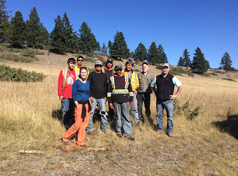
Project leaders Jim Young (far right), Ordell Steen (second from right) and their work crew pose for a photo with HCTF Biologist Kathryn Martell.

As part of our evaluation program to ensure HCTF funds are benefiting fish and wildlife conservation, HCTF staff regularly visit project leaders to get an in-depth look at their projects – both on paper (financials) and on the ground.

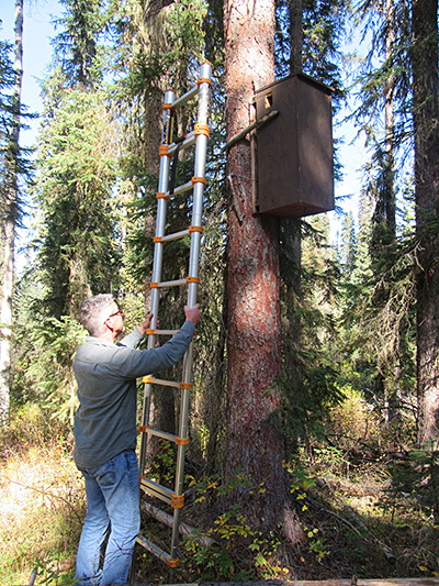
In late September HCTF staff biologist Kathryn Martell and financial officer Katelynn Sander travelled to Williams Lake to conduct evaluations on two projects. The first was the Fisher Artificial Reproductive Den Box Study led by Larry Davis of Davis Environmental Ltd.

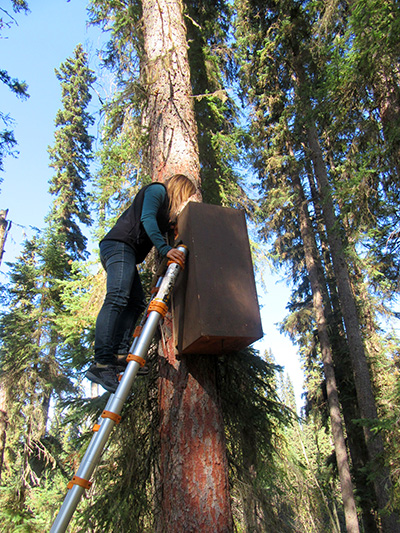
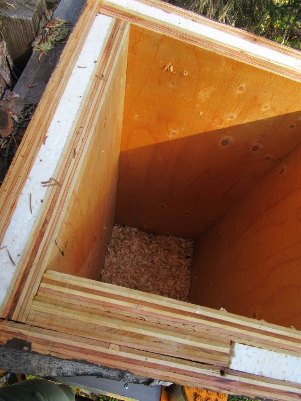
Fishers are a threatened species in British Columbia and are also the largest obligate tree-cavity user in North America. They typically use cavities in large diameter trees both for resting in winter, and as reproductive dens. Suitable den trees are rare in the landscape and impacts in many areas of the province have further reduced the availability of this habitat feature. Larry’s project seeks to determine if fishers will use artificial (man-made) den boxes for reproductive dens, as a way to augment denning habitat in areas where natural den trees have been reduced.

This year of the study continued the monitoring efforts on the 56 den boxes installed during this project. Larry has been successful in attracting fishers to 50% of the den boxes, using them for resting, and more den boxes are being used for reproduction each year.

Biologist Larry Davis readies the ladder for inspection of one of the den boxes.

HCTF Finance Officer Katelynn Sander peers into the den box.

Nothing inside this one...

Close-up of the exterior of the den box.

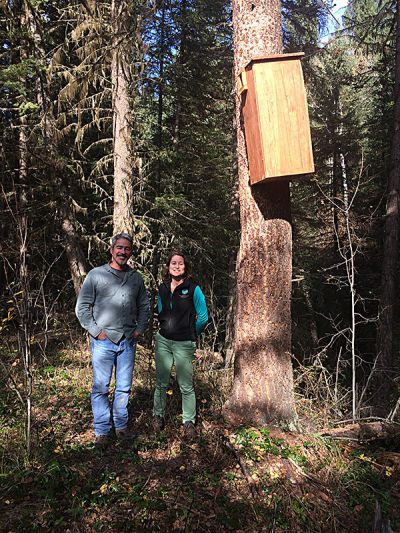
HCTF biologist Kathryn Martell and Larry Davis pose for a photo after putting the ladder away.

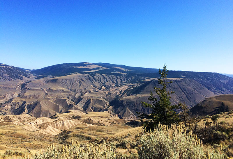
The second project staff explored was the High Lake Grassland and Open Forest Restoration Pilot, led by the Friends of Churn Creek Protected Area Society. The goal of this project is to restore approximately 80 ha of mixed open grassland and dry, open forest habitats which have been degraded by tree encroachment and ingrowth in Churn Creek Protected Area (CCPA). The project is also designed as a pilot to evaluate an approach for encroachment and ingrowth removal that does not require broadcast burning. Logistical constraints restrict using broadcast burning in High Lake and other parts of CCPA, and many of the young trees are already too large to be killed using this technique. Rather, in this pilot, stems are slashed and piled and the piles burned in winter.

Churn_Creek_view.jpg

The project area is within important mule deer range and is located on a designated no-grazing benchmark within the CCPA. Fixed plots have been established to document pre-treatment tree cover, undergrowth vegetation, and mule deer use and measure changes following restoration treatments. Much of the tree encroachment and ingrowth on the project area consists of relatively large (> 4 m tall), often dense (closed or moderately closed canopy) stems.

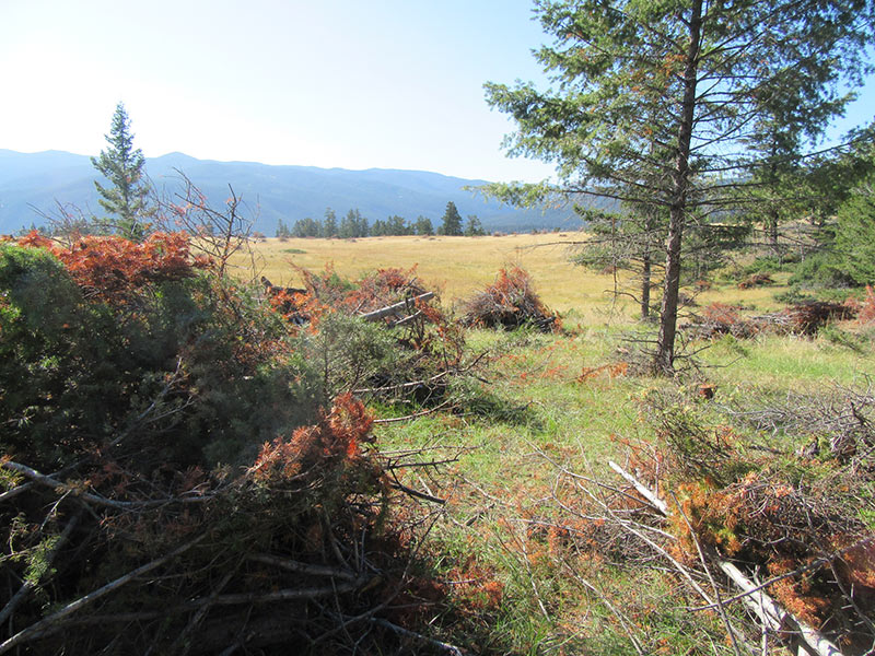
Tree encroachment was felled and piled by a Stswecem’c-Xgat’tem First Nation crew. Felling on 51 ha (72%) of the encroached grasslands was completed in the summer of 2015, and they were nearly finished when the HCTF team visited in September 2016. Burning the piles is set to take place this winter. You can already see a dramatic difference on this landscape as encroachment areas are being opened up and restored to dry grassland and open forest. This piloted approach has the potential for significant habitat enhancement, in the Churn Creek Protected Area and elsewhere.

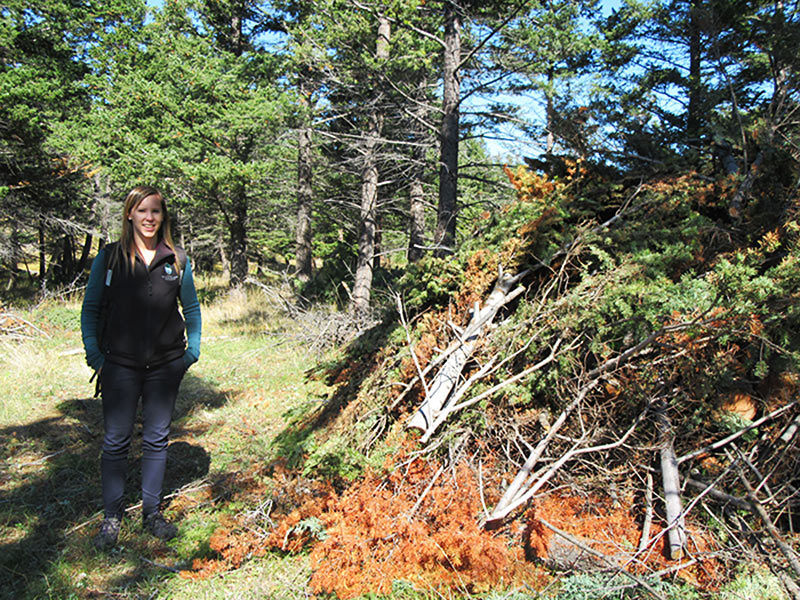
Katelynn stands next to a pile of slashed trees that will be burned in winter.

The slashing helps open up the grasslands, mimicking the historical fire regime and improving habitat for wildlife.


HCTF would like to extend a big thank you to the Friends of Churn Creek Protected Area Society, the Stswecem’c-Xgat’tem First Nation crew, and Larry Davis for taking the time to explain the projects and show HCTF around their sites. We were impressed with how well managed and implemented both projects were, and it was great to meet the passionate individuals who are making this happen.

Wed, 31 Aug 2016

Monitoring Vancouver Island Estuaries

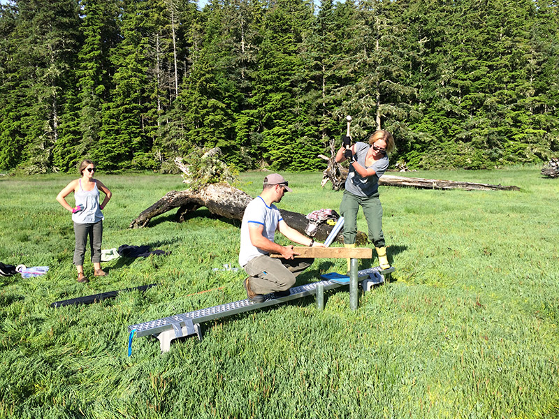
Installing-SET-Platform_Cluxewe_July2016

Thanks to Karen Barry from the VICLMP program for sending us this project update!

The Vancouver Island Conservation Land Management Program* has initiated a long term monitoring program to assess the health of estuaries and salt marshes on the east coast of Vancouver Island with support from HCTF and other partners. The goal of this monitoring program is to ensure that conservation lands provide high quality, accessible habitat for fish and wildlife, and to identify conservation concerns resulting from threats such as sea level rise, invasive species, or other human-induced changes. By implementing a standardized monitoring program, we can ensure investments made towards protection of sensitive estuaries are secured for the long-term.

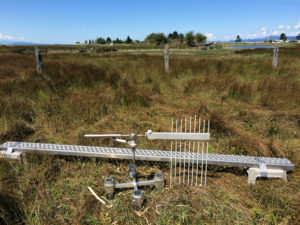
To determine the resiliency of coastal estuaries to sea level rise, we are installing Surface Elevation Tables (SET) platforms in several estuaries this summer, including Quatse River, Cluxewe River, Salmon River, Englishman River, Nanaimo River and Cowichan River estuaries. These devices allow us to see how salt marshes and estuaries are changing over time, by measuring changes in elevation of the substrate. The SET consists of an aluminum platform that is permanently installed in the estuary and anchored to prevent any movement. To take measurements, a specialized reader arm is brought out to the estuary, mounted to the platform and several rods are lowered from the arm onto the surface. Because the location and orientation of the device is fixed during sampling, we can record highly precise elevation measurements. Annual fine-scale readings are compared over time to see how much deposition or erosion is occurring.

When measurements indicate a positive change in elevation, it means that sediment is being deposited, the plants are healthy and stabilizing the sediments, and the underlying marsh soils are getting thicker (accreting). This is a natural process in healthy salt marshes which increases the resiliency of estuaries to rising sea levels. In contrast, negative readings indicate decreasing elevation which means that the marsh surface is sinking (subsiding) or eroding. When the rate of sediment deposition (or accretion) does not match or exceed the rate of subsidence or sea level rise, the salt marsh can eventually “drown” meaning that it becomes sub-tidal. This can result in significant habitat changes for fish and wildlife; for example, vegetated salt marshes can become unvegetated mud flats.

Results from our SET measurements will provide important information about local ecosystem change that can help inform management. Specifically, we will gain a better understanding of whether our estuaries are resilient over the long term, what habitats may be most vulnerable to sea level rise, and what potential restoration actions may be warranted to maintain or improve fish and wildlife habitat.

* The Vancouver Island Conservation Land Management Program (VICLMP) is a strategic partnership program with Environment Canada-Canadian Wildlife Service, the Ministry of Forests, Lands and Natural Resource Operations, Ducks Unlimited Canada, The Nature Trust of British Columbia, and funding from Habitat Conservation Trust Foundation. VICLMP’s work focuses on managing over 100 conservation areas on Vancouver Island and the central and north coasts.