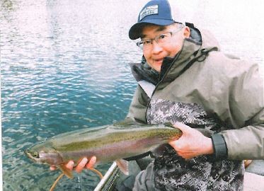
British Columbia is blessed with an abundance of freshwater resources. Over 16,000 lakes alone are found scattered throughout the province. Our lakes offer some incredible fishing opportunities, and those located in the interior regions of the province are often glowingly referred to by anglers in the know as the best blue ribbon trout fisheries found anywhere in North America.
The backbone of our lake fisheries are those which provincial fisheries managers refer to as small lakes. They include those that are less than 2200 acres in surface area and with the vast majority being less than 220 acres. Furthermore, stocked small lakes play a huge role in creating and sustaining angling effort in the province. Approximately 800 lakes are stocked annually by the Freshwater Fisheries Society of BC. Analysis of long term angler effort data reveals that stocked small lakes support over 50% of the total annual freshwater fishing effort in the province.
So why are small lakes such an attraction for anglers? Much of their popularity comes down to where they’re located. The interior regions of the province from the Okanagan through to the Peace River are richly endowed with productive or nutrient-rich lakes. Many of these waterbodies were created several thousand years ago when the last of the glaciers receded, leaving behind scoured-out depressions that filled with water. Their shallow nature and fertile basins combined with a long, hot growing season proved to be the perfect combination for growing trout. There are also a number of nutrient rich lakes that are found on Vancouver Island and the surrounding Gulf Islands that have been managed for recreational trout fishing for decades.
Ecologically, many of these nutrient rich small lakes are classified as being in a eutrophic state. These lakes are typically shallow, with maximum depths of less than 50 ft and average depths of less than 15 ft. They are often landlocked or have only intermittent or seasonal stream connections. Because they are rich in nutrients, they are abundant in aquatic plants and invertebrates. Eutrophic lakes can be extremely productive and have the capability to grow trout and char very quickly and to large sizes. However, the same features that make accelerated growth possible in the summer can make it difficult for trout to survive over winter. Some of our most popular interior trout lakes are marginal in terms of their ability to support trout through the colder months due to a drop in dissolved oxygen levels Thousands of small trout lakes in BC’s interior freeze over for 4 to 6 months each winter. During that ice-covered period, the aquatic plants that grew through the open water seasons die off from lack of sunlight. Dissolved oxygen in the water is used up as this plant matter decomposes. As winter progresses, the volume of oxygenated water decreases to levels that become too low to support trout life, which results in a winterkill.
There are also small lakes located in the coastal regions that suffer from severe oxygen depletion during the summer months. This affects the ability of trout to survive as well as having impacts on the quality of the water for domestic use and other forms of aquatic recreation.
Lake aeration and artificial circulation is a tool that allows fisheries managers to improve over-winter trout survival in interior lakes susceptible to winterkill and provide summer refugia in eutrophic coastal lakes. In order to understand how aeration works, one needs to be aware of the seasonal changes that occur in a small lake, and how thermal stratification affects where trout can live in those waterbodies at various times of the year.
Eutrophic lakes undergo complete mixing, also known as turnover, in the spring and fall. In the spring, the lake mixes when surface temperatures become similar to that of the deeper water. Several days of wind will completely mix the entire water column, the end result being a lake fully charged with oxygen.
As summer progresses, warm air temperatures heat up the upper layers of lake water, but the energy of the sun can only penetrate so deep: beyond that depth, the water remains cold. The upper layer of warm water is referred to as the epilimnion, and the colder, deeper water is the hypolimnion. The transition zone that separates the epilimnion from the hypolimnion is known as the thermocline. The thermocline acts as an invisible barrier to the mixing of the two layers, leading to steadily decreasing levels of dissolved oxygen in deeper waters and an overall reduction in water quality.
In the late fall, as surface temperatures cool down to match the temperature of deeper water, eutrophic lakes will mix again. Brisk winds circulate the entire water column and result in the entire lake becoming well oxygenated and ready for winter.
History of Lake Aeration in B.C.
Lake aeration and artificial circulation projects were first developed in the early 1960s to address winter oxygen concerns on a number of lakes in the Okanagan and Thompson/Nicola regions. Electric or diesel powered air compressors were used to deliver oxygen through an airline and diffuser system placed in the deep part of the lake basin. Referred to as de-stratification systems, the constant stream of air bubbles created an upwelling circulation that brought deeper water to the surface where it was exposed to the air/water interface. Limited oxygen absorption into the water occurred with the release of the diffused air as well as at the lake surface.
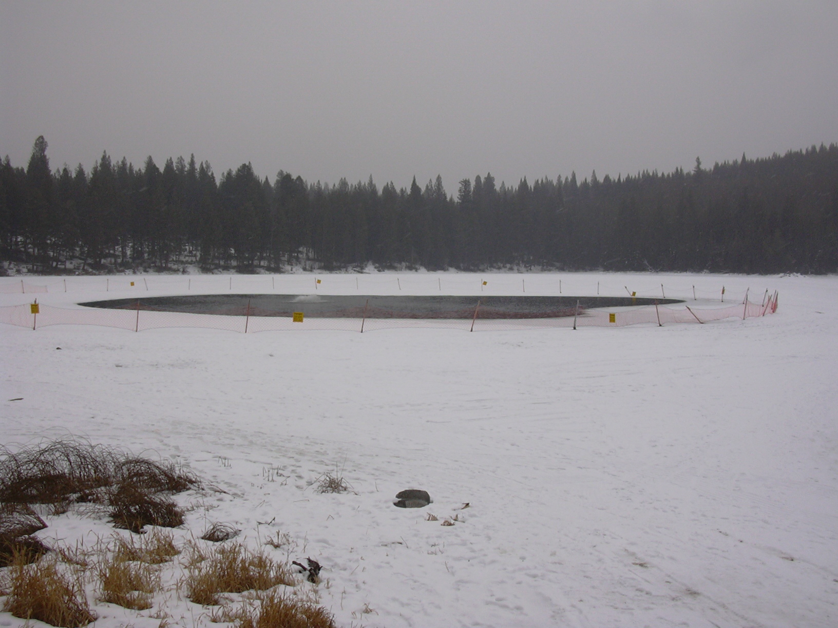
The cost to operate and maintain these diesel and electric units proved to be very high, so other aeration/mixing systems were tested during the 1970s. Wind and solar-powered aeration units provided inconsistent results and were not well-suited to the cold, interior winter climate. It became clear that a reliable source of power was needed to successfully operate any aeration or circulation system. In the 1980s, small electric-powered floating aeration units were tried on numerous small interior lakes. These units consisted of a sealed, submersible electric motor equipped with a small propeller. They were positioned on a wooden float, and the unit suspended just below the surface of the lake. The unit pulled water from the surrounding area up to the surface along with spraying of water into the air where oxygen transfer and mixing occurred. These systems were less expensive to operate and simpler to maintain than previous models and are still used in many BC lakes today. They are typically turned on after fall turnover and then operated through the winter months. Anglers fishing aerated lakes will be familiar with the orange safety fencing that is placed at a distance around the open water surrounding the operating aerator. This fencing and accompanying signage is placed to keep anglers and other recreationalists at a safe distance from any potential thin ice.
Hypolimnetic Aeration
At the same time that electric-powered aerators were being placed in BC’s interior lakes, specific lakes on southern Vancouver Island and Salt Spring Island were being assessed for aeration suitability. These lakes were undergoing cultural eutrophication from rapidly increasing agricultural and residential development within their watersheds. Summer algal blooms, deteriorating potable water quality, and oxygen depletion concerned both fisheries and water management agencies.
An appropriate aeration system could sustain angling opportunities while improving water quality for domestic use and other forms of aquatic recreation. The first hypolimnetic aeration units were installed on Long Lake near Nanaimo, and on St. Mary’s Lake on Salt Spring Island. These were huge units requiring helicopters to lift them in place. They consisted of two large galvanized steel tubes attached to a floating box or separator raft. The tubes hung straight down and extended to the deeper parts of the hypolimnion. A diffuser with air stones was situated in the very bottom end of the intake tube, and a hose system supplied a steady stream of air to the diffuser by way of an electrical compressor. The air bubbles rising up the intake tube would create a current of water pushing to the top of the tube and then flowing down the exit tube, which was situated next to the intake tube within the separator box. This continuous circulation of aerated water resulted in marked increases in the oxygen content within the hypolimnion, while at the same time not affecting or breaking through the thermocline. The result was improved deep water fish habitat as well as reduced blue-green algal blooms which were the cause of poor water taste and quality.
Role of the Habitat Conservation Trust Foundation in Lake Aeration
Lake aeration systems were proving to be effective for both increasing winter and summer survival of trout as well as improving water quality. Unfortunately, the high cost to build, install and operate these systems meant the provincial Ministry of Environment could not continue to expand the program. It was then that the Habitat Conservation Trust Foundation (HCTF) stepped up to the plate. HCTF began in 1981 as an initiative of anglers, hunters, trappers and guide-outfitters who were willing to pay more for their licence fees if this additional funding was used to enhance fish and wildlife populations and to acquire important fish and wildlife habitat. To date HCTF has invested over $700,000 in the installation of aeration systems and provided more than $3 million dollars for the operation and maintenance of these units. The provincial lake aeration program is just one of the many habitat improvement projects that would not exist without the financial support of the Habitat Conservation Trust Foundation and licenced anglers in BC.
The Current State of Lake Aeration in B.C.
Currently, there are 20 aerated lakes across 5 different regions of the province. 4 of these are hypolimnetic systems (similar to St. Mary’s Lake), and the remaining 16 are the surface mounted de-stratification style units. Annual operation of these systems helps to sustain recreational fishing opportunities that would not otherwise be available.
For example, Red Lake located NW of Kamloops is a very popular rainbow and brook trout fishery that, prior to the installation of a hypolimnetic aeration system, would winterkill on a regular basis. Today, there are approximately 8000 angler days per year spent on this lake, with about half of that effort occurring during the winter months. This hypolimnetic aeration unit uses the latest technology which includes removing nitrogen from the air being pumped into the diffuser tube which results in close to 100% oxygen versus normal air which contains 23% oxygen. The end result is increased oxygen transfer into the water column. These hypolimnetic units also have the benefit of not creating open ice on frozen lakes. While these units are still often fenced off with safety netting, the liability concerns are significantly reduced. Simon lake is located in the southern Cariboo region just north of the town of 100 Mile House. Simon is an extremely productive waterbody that is managed for quality fishing. A surface mounted aeration unit operate through the late fall and winter months to sustain fish that reach in excess of 10 lbs. The opportunity to catch a trophy sized rainbow attracts over 1000 angler days a year to this small lake.
Other aeration projects have not been as successful. St. Mary’s Lake received the first hypolimnetic systems back in the early 1980s. It operated adequately for a number of years, but when the original unit was replaced with a larger system, the results were not as expected, and the system was eventually shut down.
Aeration is not a magic bullet to solve all fish survival and water quality issues in eutrophic lakes. It is one tool in the tool box that fisheries managers can consider for specific water bodies when conditions are right.
Brian Chan has been fortunate enough to live and work for the past 35 years in Kamloops, British Columbia. It is here that Brian, as a provincial fisheries biologist, managed the recreational stillwater trout fisheries in the Thompson/Nicola Region, and developed his fishing skills. Brian’s lifelong passion for fly fishing has resulted in his spending literally thousands of angling days on these world class waters. He has shared his extensive knowledge of aquatic biology, trout ecology, entomology, and lake fly fishing tactics with others, through magazine articles, books, and instructional DVDs. Brian has been featured on many TV fishing shows and is currently a regular guest on Sport Fishing on the Fly and co-host of The New Fly Fisher.


