Mon, 28 Sep 2026

Courtenay’s Old Sawmill Restored into Thriving Wetland

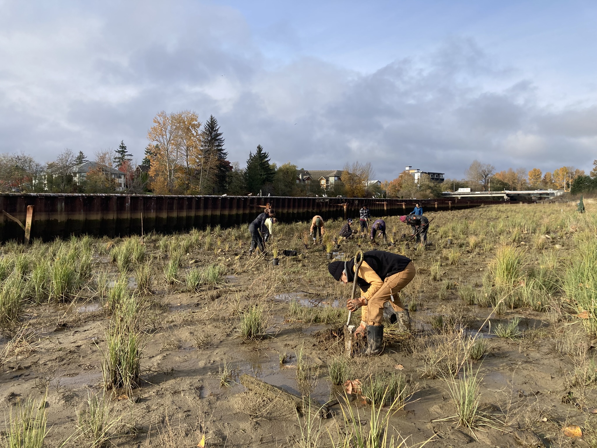
Project Watershed volunteers planting lower bench tidal marsh plants such as Lyngbye sedge, Baltic rush, and Pacific silverweed - photo by Casey Doucet

Thriving wildlife habitat doesn’t have to be far from where people live. Within walking distance of downtown Courtenay, B.C., fish and wildlife are beginning to call a shoreline home again.

It’s where the old Fields sawmill stood out of service for two decades. Soon, the site – called Kus-kus-sum – will have its title transferred to the local K’ómoks First Nation.

The serene landscape conceals the massive effort required to restore it. “Nobody would ever know it was anything but a tidal marsh,” says Caitlin Pierzchalski, executive director of Project Watershed, the non-profit that led the ambitious restoration.

The project is a collaborative effort led by the Comox Valley Project Watershed Society, in partnership with the K’ómoks First Nation and the City of Courtenay. Habitat Conservation Trust Foundation supported the project from 2021-2026 with over $340,000 through the Fish & Wildlife Grant program, and we are grateful to stand alongside the many donors whose support helped restore the site’s ecological function and return the land to its original stewards.
The final phase of Kus-kus-sum restoration was the removal of the steel retaining wall. From Jan-Feb 2026, each panel of the wall was lifted out by a crane on a floating barge before being trucked away for recycling – photo by Caila Holbrook

Salmonids and native plants return to Kus-kus-sum
Transforming a former sawmill into a habitat where fish and wildlife can thrive is an audacious task. Toxic soils have to be disposed of safely. Carting off tonnes of steel, concrete, and other heavy materials takes months of careful work. Like many riverside sawmills, this one was bordered by a steel wall to prevent flooding. Somehow, dismantling and removing all 400 metres of it turned out to be one of the project’s more straightforward challenges, Pierzchalski recalls.

Project Watershed knew the ecological benefits would be worth the effort from the start. In 2012, the Comox Valley-based nonprofit identified Kus-kus-sum as a top priority for restoration, despite the scale of the undertaking. The sawmill’s location had severely degraded habitat for salmonids, a family of fish that includes trout and char (and of course, salmon).

A 1977 government report preceded this sentiment, identifying the surrounding Comox Estuary as one of the most productive in Canada and recommended relocating the sawmill. The K’ómoks people had long known this. Their ancestors established a fishing village, relying on the area’s abundant salmon.

Today, volunteers have planted thousands of native plants across the site. Beneath the river surface, logs and other woody material offer refuge for juvenile Chinook salmon and cutthroat trout. Monitoring cameras are already showing promising data on their numbers.

Cultural significance and land title
Returning this site to those who came before doesn’t just mean wildlife and native plants. Up until 1949, when the sawmill was built, the K’ómoks people depended on this area for their livelihoods and cultural practices. They fished nearby and also laid community members to rest at that site through tree burials. In a tree burial, bodies are encased in wood or cloth, and placed high up in the branches so that they would be closer to the sky.

For Pierzchalski and Project Watershed, restoring traditional stewardship to Indigenous leaders is central to the project’s story. Before work began, Project Watershed entered into an agreement with the City of Courtenay and the K’ómoks First Nation that said the non-profit’s job was to look after the site’s restoration, after which title to the land would be transferred to the nation.

“Most people see this as the old Fields sawmill site. Now they see it as a restoration site. But they’re not often thinking of the pre-industrialized context of the site,” says Pierzchalski.

Hope for other industrial shorelines in B.C.
Aging industrial shorelines are now increasingly common across B.C. Former sawmills, pulp mills, and coal-coking sites have left contaminated soils and heavy infrastructure in their wake. Restoring these sites can be complicated and expensive. Some sites sit dormant without a clear path forward. Others are repurposed for more contemporary industries that benefit from similar infrastructure.

But Kus-kus-sum shows what can happen when a community chooses naturalization. The restored shoreline is showing stability day by day. The site was designed to also help protect against flooding and rising sea levels. The native plant species, though early in their growth, are already establishing well, and Project Watershed hopes to see more juvenile Chinook and Coho salmon using the site over time.

Project Watershed has also built knowledge that can help others pursue similarly ambitious restorations, particularly when it comes to navigating evolving regulations. Requirements for handling and disposing of contaminated materials changed throughout the project, creating challenges for which there was little precedent. Having found a way through, the team can now share what it learned with those undertaking similar work.

What was once a barrier between land and water is now a place where migrating fish stop to rest and native plants take root again. With the removal of the steel wall and reconnection of the site to the Courtenay River, Kus-kus-sum has been transformed from an industrial site into a thriving estuarine habitat that supports fish, wildlife, and plants, while creating a lasting space for cultural connection, ecological resilience, and community stewardship.
 

Mon, 9 Sep 2024
Tags: F&W / News / Wildlife

Owl Habitat Suitability in Post-Fire Forests

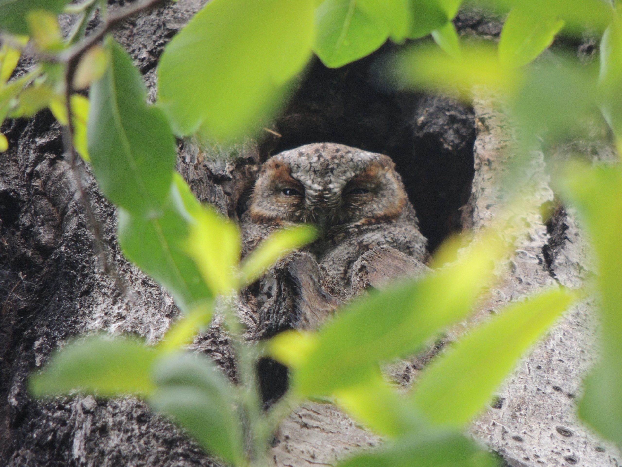
An owl spotted during the study - photo by Marcus Cosentino

HCTF is proud to support 178 fish and wildlife conservation and conservation stewardship projects across B.C. this year, with more than $1.5M in funding allocated to projects in the Thompson Okanagan region.

Among this year’s projects in the region is a two-year study of how wildfires of different ages affect the distribution of owls in the Okanagan Valley. “Owls help regulate prey populations and are culturally significant to local Indigenous communities. They are threatened by wildfire, which removes forest features needed for breeding and hunting,” says project leader Karen Hodges of the University of British Columbia Okanagan. MSc student Steffani Singh is surveying which owl species are present in post-fire forests and determining where owl nests are and what the owls are eating in these burned landscapes. The project will thus inform the management about what features of burned forests are essential for owls, leading to better habitat conservation. The project is being supported by the HCTF and the Forest Enhancement Society of BC (FESBC), with $66,401 in funding this year.

View of an area post-wildfire – photo by Nikita Karitsky

Dan Buffett, CEO of HCTF, said, “Over the last seven years, FESBC contributed over $4.5M to HCTF to fund wildlife projects in our forests. Our partnership enables project leaders such as UBCO to assess the impact of wildfires on wildlife and develop guidance on how to better manage forests for wildlife. Projects such as Dr. Hodge’s work on owls, along with many other wildlife projects, will continue to fill our knowledge gaps to improve habitat for wildlife.”

Learn more: listen to an interview with project lead Steffani Singh here.

Other HCTF-funded projects taking place in Thompson Okanagan include:

  • $22,730 to measure how changes in Douglas-fir forests affect mule deer habitat and how to better support the mule deer population in the Bald Mountain range west of Summerland (co-funded by FESBC).
  • $295,500 to rebuild the Mission Creek Spawning Channel intake, ensuring spawning migration access and higher survival rates for juvenile kokanee.
  • $62,750 to restore habitat on approximately 23 km of roads within the Caribou North and Groundhog caribou herds’ range.
  • $93,615 to install a resistivity counter in the Upper Shuswap River to monitor Bull trout migration and provide spawning and movement patterns.
  • $24,906 to build capacity for and understanding of environmental and wildlife initiatives in the Nlaka’pamux Homeland.
Fri, 6 Sep 2024
Tags: News / Wildlife

How Prescribed Fire is Helping Enhance Stone’s Sheep Habitat in B.C.

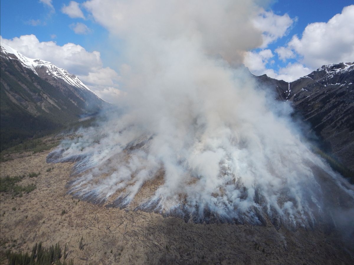
Implementation of a prescribed burn for Stone’s sheep habitat - Ridgeline Wildlife Enhancement

In the remote, rugged, Northeastern terrain of B.C., nearly half of the world’s Stone’s sheep habitat can be found. These sheep and the ecosystem surrounding them have been supported through careful forest management practices since the 1970s. One such practice, jointly funded in recent years by HCTF and the Forest Enhancement Society of BC (FESBC), is prescribed fire.

In May 2022, approximately 160 hectares of Stone’s sheep winter habitat were treated with prescribed fire. This initiative targeted four specific slopes (hillsides), utilizing aerial ignition techniques (dropping fire from helicopters) to reduce woody vegetation, enhance forage quality, and improve predator detection capabilities for the sheep. This treatment was part of a broader objective to restore and maintain habitat not only for Stone’s sheep but, in future project years, also for bighorn sheep, which inhabit the southernmost extent of the region.

“Prescribed fire is a long-standing management practice to restore important foraging habitats for wild sheep and many other species such as moose, elk and mule deer. HCTF is proud to co-fund this work with FESBC so that our project leader can complete this critical work to benefit Stone’s sheep in the Peace Region,” remarks Dan Buffett, CEO of HCTF. “It’s a great project involving a wide variety of partners generating benefits well beyond wildlife to improve the broader forest ecosystem and create a better patchwork of grasslands and different aged forest stands over the landscape.” Viewed from above, the patches appear to be irregular in size, shape, and distribution. This is what natural landscapes often look like when fire is allowed.

In May 2024, before the summer season of wildfires experienced throughout the province, Ridgeline Wildlife Enhancement Inc., on behalf of the Wild Sheep Society of BC, worked on the project to undertake two prescribed burns. They successfully enhanced over 600 hectares or 1,400 acres of Stone’s sheep habitat using prescribed burning treatments. The resulting post-burn habitat will improve forage (food for sheep) quality and reduce dense shrub cover (so the sheep can see predators from a distance).

“The funds provided by HCTF and FESBC result in a direct, on-the-ground, immediate benefit to Stone’s sheep and their habitat,” explained Alicia Woods, a wildlife biologist with Ridgeline Wildlife Enhancement. “Within 10 days post-burn, new vegetation was visible on-site, and by eight weeks post-burn, the site was beginning to revegetate with new forage. We often see sheep move into a burned area within a few weeks to graze on the new growth. Funding for prescribed burning projects also contributes to landscape-level ecosystem restoration, reducing fuel loads, and includes benefits to other species that rely on sub-alpine grasslands.”

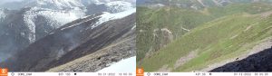
During and 6 weeks after a burn, seeing the return of the forage – Ridgeline Wildlife Enhancement

While the primary objective focused on strategically removing of brush and old vegetation to promote the growth of new, nutrient-rich vegetation, Woods emphasized the prescribed burns’ dual benefits, both for habitat management and as a proactive measure against uncontrolled wildfires. “By reducing the fuel load through controlled burns, we not only helped improve habitat quality but also helped mitigate the risk of severe wildfires,” she said.

An interesting objective of this project is that Woods’ team also focuses on studying and researching the impact of prescribed burns on sheep health and their habitat.

“In addition to the on-the-ground habitat benefits, funding contributed by HCTF and FESBC support a research component of the project that includes an assessment of wildlife and vegetation response to prescribed burns. In partnership with the University of Northern British Columbia, PhD students will further investigate how the habitat treated with fire may affect Stone’s sheep health. In a region that supports 50 per cent of the global population of Stone’s sheep, the enhancement of sheep habitat through this prescribed burn program has substantial benefits to this iconic species,” said Woods.

A novel aspect of the project focuses on the indirect assessment of sheep health by analyzing pellet samples for stress hormones and nutritional status indicators. This method offers a non-invasive way to gauge the potential health benefits of the burns to the sheep.

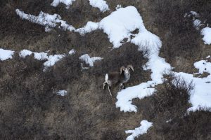
A Stone sheep returning to a site post-burn – Ridgeline Wildlife Enhancement

“As professional foresters making forest management decisions, we are often asked to manage multiple resources and values. The partnership between HCTF and FESBC provides funds to help research, investigate and find solutions in an ever-changing forest landscape on forest stewardship, specifically focused on wildlife and associated ecosystems and habitats,” said Tyler Field, Registered Forest Professional, operations manager with FESBC. “This year, for example, we are jointly funding several long-term projects that look at the effects of wildfire on certain wildlife species, which could help forest professionals make decisions in the future on using fire as a forest management tool in cultural and prescribed burns.”

While in the past couple of years, the project leaders have seen success, they have faced several challenges to get to this point:

  1. The logistics of such an extensive project, especially for reaching remote areas, are extremely difficult. For example, one helicopter trip to the more remote study areas costs roughly $6,000, and the project team needs to visit the sites for monitoring at least four times a year. That is why, apart from the HCTF and FESBC support, the project has additional support from the Wild Sheep Society of BC, Wild Sheep Foundation, North Peace Rod & Gun Club, and the University of Northern BC.
  2. Obtaining necessary government permits is a lengthy and complex process Woods shared, often taking years to navigate through bureaucratic layers. The project has submitted 25 burn permit applications and notably secured 14 burn permits, of which they have already treated six areas.
  3. Even after burn permits are secured, it isn’t as straightforward as implementing the burns. “Spring prescribed burns occur in a narrow window that happens sometime between when the slopes become snow-free and before the site greens up. Sometimes, this window can be as narrow as one week,” explained Woods. The narrow window for suitable burning conditions requires precise timing and flexibility, and the unpredictable weather patterns of recent years and increasing dry periods due to climate change have complicated scheduling and increased the risk of unintended fire escapes from the target burn area.
  4. For Woods, it is important for the public to be aware of the differences between wildfires and prescribed burns and learn why these burns are essential for maintaining ecological balance. “Prescribed burns are done in a very controlled fashion. There are very specific targets with very specific objectives. How we do it, and the conditions we do it under, are also carefully chosen,” said Woods. “The devastation of wildfires we see on the news is not how a prescribed burn site looks; after a prescribed burn the site flourishes with new vegetation.”

Woods also wants people to understand that controlled burns have always been an integral part of Indigenous practices and culture.

“The support and involvement of local First Nations, such as Fort Nelson First Nation, Halfway River First Nation, Doig River First Nation, and communities in the Kaska and Kwadacha traditional areas is not just beneficial but essential. They bring a perspective that enriches our understanding and approach,” said Woods, adding, “What they tell us about burning is also what we see, which is exciting because it confirms what I see on the ground. We conduct the burns similarly to how the First Nations used to do it – during the spring when the frost is still in the ground, so the burn doesn’t harm the soils – as a tool of controlled burning for the benefit of enhancing wildlife habitat and improving the ecological balance in the area.”

The project has become a leading example of how integrating Indigenous ecological knowledge with contemporary scientific practices can lead to more effective and sustainable forest management. Next, the project plans to expand the treated areas, aiming to cover between 500 to 1,000 hectares annually across multiple study areas.

“Our goal is to establish a cycle of burns that continuously rejuvenates the habitat,” she explained. “Ideally, we’re looking to manage these lands in a way that maintains ecosystem diversity across the landscape, which will, in turn, support the wildlife the northeast is renowned for.”

Through the dedicated efforts of Woods and her team, the prescribed burning projects in Northeastern B.C. demonstrate that thoughtful, well-managed fire regimes can profoundly benefit wildlife and ecosystems.

Wed, 4 Oct 2023

Project Profile & Lessons Learned: Goldway Road Restoration

Goldway Road Restoration - Chu Cho Environmental LLP

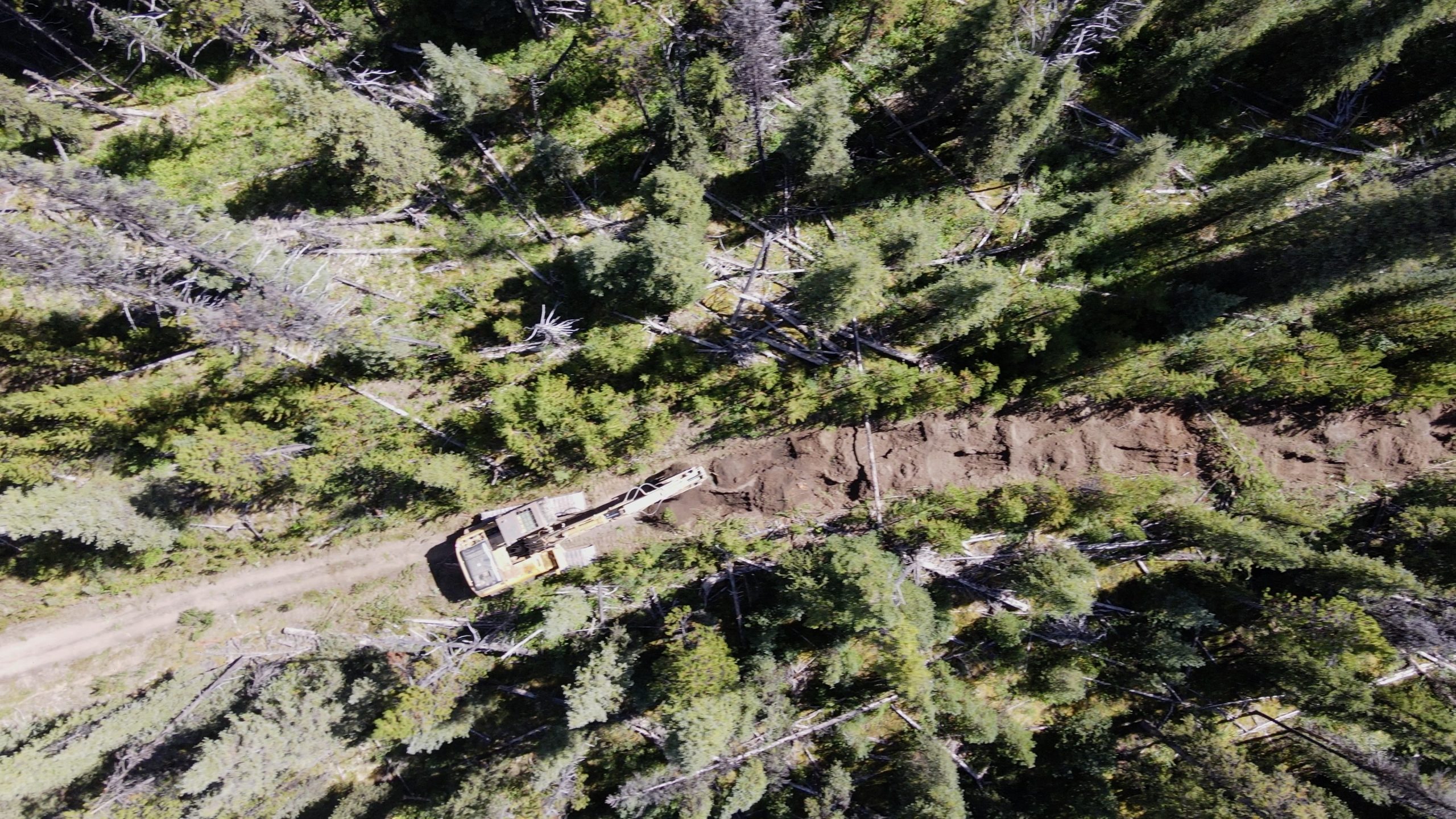
In 2018 Chu Cho Environmental identified several candidate roadways for restoration within the Chase caribou herd range with input from forest licensees, caribou biologists, and Tsay Keh Dene Nation. In total, Chu Cho Environmental and Tsay Keh Dene Nation have now completed restoration work on 3 roads within the Chase caribou herd boundary since 2019. Collectively, these projects have been a part of the larger Chase Caribou Road Restoration Program (CCRRP), with the Goldway road being the most recent restoration project.

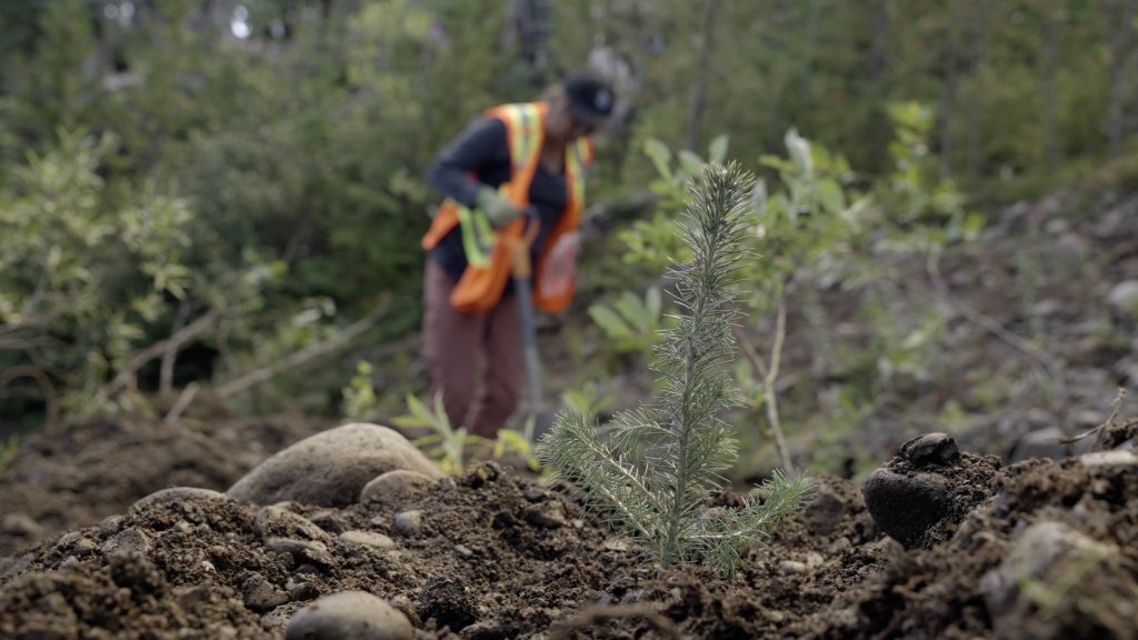
Planted Seedling – Chu Cho Environmental LLP

Sean Rapai of Chu Cho Environmental shares the challenges and lessons learned on this project including those around permitting, post-treatment monitoring and longer-term considerations.

Permitting: The historical presence of anadromous salmon in Johanson Creek, combined with the presence of bull trout and steelhead trout impacted the window for fording Johanson Creek with an excavator. It was necessary to submit an application to Fisheries and Oceans Canada (DFO) with the proposed plan and timing window of the work. The Letter of Advice was eventually secured which indicated work could proceed as planned. Best practices were outlined as well as recommendations for the fording process. This proved challenging, but the project did receive approval from DFO.

Monitoring: Ecological restoration treatments could take five or more years to begin to show results. With monitoring, we are attempting to answer a long-term set of questions and return to the site in the years immediately following restoration. Monitoring can be very costly as assessing control treatments is often restricted to the use of a helicopter. Chu Cho Environmental investigated the feasibility of using remotely piloted aircrafts (drones) as a more cost-effective method of monitoring restored areas in the short-term. This method was explored for monitoring remote roadways and restored areas.

Drone-based monitoring: Based on recommendations from 2021, Chu Cho Environmental deployed drone-based remote-sensing surveys to monitor vegetation using derived NDVI indices. Data was collected to a resolution of 1 m2 and can be paired with future surveys to track vegetation establishment and growth along large stretches of the road. While the use of a drone as a monitoring tool in this restoration program is in the preliminary stages, the ease of data collection and results suggest this is a viable means of evaluating vegetation indices on pre and post restoration roadways.

Stability of ecological restoration treatments: Year one monitoring of the ecological restoration techniques used in the project showed strong persistence of these treatments. The rough-and-loose soil contouring was stable, intact, and holding water, and planted seedlings had a high survival rate.

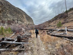
Recontouring inhibits human access: Areas recontoured with the rough-and-loose treatment had the least evidence of use by humans, including those on horseback. Aggressive recontouring of roads at strategic locations may be considered a viable tool to discourage trail usage and eliminate all-terrain vehicle use.

Snow alters access by motorized vehicles: Snowmobile use of the road was observed when the snow had accumulated above restoration efforts (i.e., above height of felled trees and mounds). While the effect of such anthropogenic use has yet to be studied here, considerations may be required for future restoration efforts or access management restrictions on snowmobile use.

Functional restoration: Felled trees were intact, and it was observed that larger diameter trees felled from steep cut banks created better movement barriers. Conversely, smaller diameter trees felled for functional restoration did not provide as good of a visual and physical barrier and is suggested that when small diameter trees are the only available source, they are felled in stacks. High survival of planted seedlings, following mechanical site preparation, suggests that tree planting is likely to provide visual screening over the long term, and may represent a more effective long term means of functionally restoring these roadways.

The Goldway road lies within the range of the Chase caribou (Rangifer tarandus caribou) herd, which is considered by the federal government of Canada to be part of the Northern group of the Southern Mountain population of Woodland caribou. This herd is listed as threatened on Schedule 1 of the Species At Risk Act (SARA).

Tue, 27 Jun 2023

Project Profile & Lessons Learned: Tweedsmuir Caribou Winter Range – Chelaslie Road Restoration

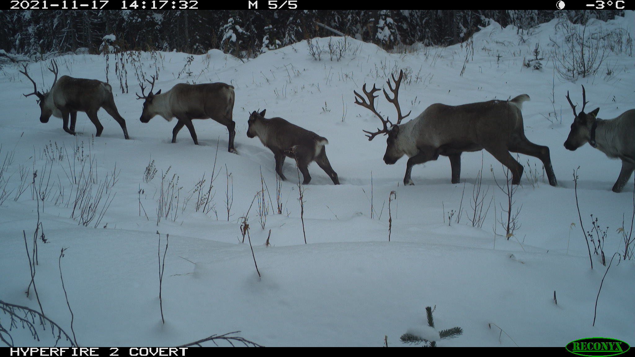
Group of caribou detected on Reconyx remote camera.

Directly east of Tweedsmuir Park, there is an area caribou utilize as their core low-elevation winter habitat and as a migration route between winter and summer habitat. It is currently heavily impacted by human-caused disturbance such as forest harvesting and associated roads. The BC Ministries of Water, Land and Resource Stewardship and of Forests have been working on a project that aims to benefit the Tweedsmuir-Entiako caribou (TEC) herd through restoration of linear disturbances in the Chelaslie migration corridor (CMC). The project includes many partners, including Cheslatta Carrier Nation and the Society for Ecosystem Restoration in Northern BC (SERN BC), working on the restoration of roads and fire guards that are no longer required. Over the 2021 and 2022 seasons, ecological and functional restoration treatments were applied to over 54 km of road and fire guard. An additional 22 km of road has been effectively deactivated through the treatment of access roads. Restoration efforts will continue in 2023, through machine work on legacy roads, planting of roads and wildfire guard, and monitoring.

Restoration activities incorporate ecological restoration, which includes site preparation and conifer planting to recover habitat suitable for caribou; and, functional restoration, which includes activities such as woody debris spread, tree felling, mounding, and berm creation. These barriers are intended to reduce line of sight and make roads more difficult to travel along, which is important to eliminate human access and reduce predator mobility. The project utilized vegetation surveys, assessments for mobility, trail cameras, drone imagery, and GPS collars to monitor the short- and long-term outcomes of restoration treatments on access, vegetation, caribou use, and use by other wildlife.

Reconyx photo of caribou bull on road 1A (treated in 2022)

Anne-Marie Roberts, Tweedsmuir Caribou Herd Program lead with the BC Ministry of Water, Lands and Resource Stewardship (WLRS) and Joanna Lee, BC Conservation Foundation (BCCF) contractor with WLRS share some lessons learned on the project so far.

Review of work to date: During the first year, the project was scoped out based on previous work and from projects in other areas of British Columbia and Western Canada. This allowed for beneficial streamlining of some of the work around restoration treatments and implementation development. Learnings from the initial year of the project also helped scope subsequent workplans, training, and reporting.

On Site Discussion: While this project utilized an experienced Project/Site manager on the machine work, a team site visit was held early before the machine work began to review implementation. Representatives from the BC Ministry of Water, Land and Resource Stewardship (Nadina Forest District + Skeena Region), Forest Carbon Initiative, Cheslatta Carrier Nation, and HCTF were in attendance and visited roads completed in previous years as well as roads to be completed in 2022 and had in-depth on-site discussions about restoration treatments and goals. This was an effective use of time to ensure that prescriptions were communicated and understood well by all involved. It also resulted in a better understanding from the machine operators that were newer to this type of project to know what the project was intending to achieve (i.e., plant-able spots, functional treatments aimed to reduce sightlines and minimize access and ease of movement).

Remote Cameras: On a more logistical note, cameras deployed in remote areas were a significant investment in time and money to deploy, check and process. Ensuring that cameras are protected as much as possible (bear boxes and possibly locks) is important to protecting the investment in that data.

Partners and Stakeholders: Working with First Nations and stakeholders is unique to each region and caribou herd, and it is essential to include inputs from different groups to this type of project. Adequate time must be set aside for meaningful input and to develop real partnerships for ongoing restoration. This will be important in the long-term implementation of restoration treatments. Through deep commitment to working together there has been significant contribution from First Nation partners to this project, caribou recovery, and in building capacity to support and lead components of this work.

Wed, 15 Jun 2022

Project Profile: Health and Behaviour of BC’s Southern Most Stone’s Sheep

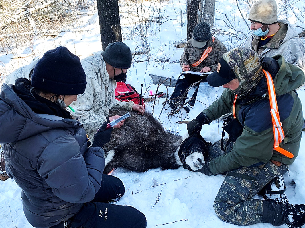
Stone Sheep Capture (photo by Daniel Mclaren of Northern Conservation)

Stone’s sheep, one of four wild sheep species in North America, can range dramatically in size and in colouring, from white to chocolate brown and black, so these sheep perfectly blend into the habitat around them. But for all we know of their beauty and range, little is known about their health and behaviour.

The mountainous areas of northern British Columbia support approximately three-quarters of the global population of Stone’s sheep, and recent genetic data confirmed that BC is home to all genetically pure populations. Also called Thinhorn sheep, which includes the subspecies Dall’s, the Dunlevy and Schooler Stone’s sheep are the southernmost extent of their range. Therefore, conservation of this subspecies is of great concern given their habitat and genetic uniqueness.

In 2020, HCTF began funding a project to study Stone’s sheep in the Dunlevy and Schooler ranges, and the project is now entering its third year. Project team lead Robin Routledge of Wild Sheep Society (WSS) believes that as BC supports the global population of this species, it is important to understand Stone’s sheep and work to protect and enhance the habitat in which they live.

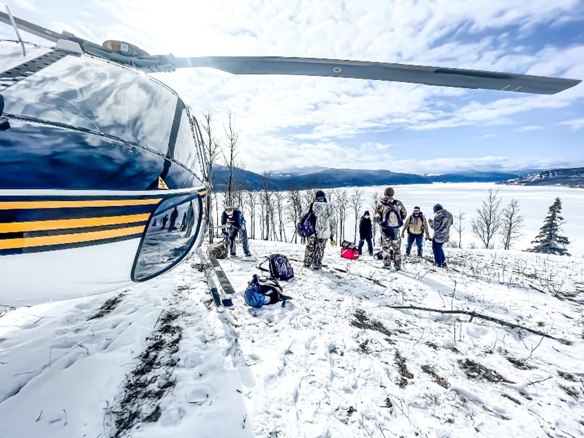
Capture Team and Helicopter (photo by Daniel Mclaren of Northern Conservation)

Recently, some concerns had been raised about potential impacts from domestic livestock and local elk herds on Dunlevy and Schooler herds, and the ecological and health conditions of the herds have not been monitored since 2005. The Dunlevy herd range is directly adjacent to ongoing anthropogenic disturbance including development and recreation. One key concern is the potential transmission of pathogens from domestic breeds to wild sheep, particularly Mycoplasma ovipneumoniae or “MOVI”; an infectious parasite that results in a deadly form of pneumonia.

The WSS of BC teamed up with Wildlife Infometrics Inc. to reinitiate a monitoring program of these herds and compare new health data to that collected in previous years (1999-2005). The hope is that this information will guide herd management and inform habitat planning and enhancement projects for First Nations and stakeholders.

In 2020, the team, along with local First Nations, started the capture and collaring of several individuals within the Dunlevy herd, and a small number of individuals in the Schooler herd. This was the first successful deployment of collars in the Schooler herd, for a total of 6 active collars in 2020, and an additional 10 collared animals in 2021 among both herds. The collars will help the team gather data on home ranges, and understand key habitat features the sheep are utilizing, to eventually inform habitat enhancement plans. Collars were distributed between ewes and rams (dependent on age, suitability, and access); an important aspect for well-rounded data as ewes tend to stay closer to a core area, moving seasonally and during lambing, while rams tend to forage outside core areas over greater distances.

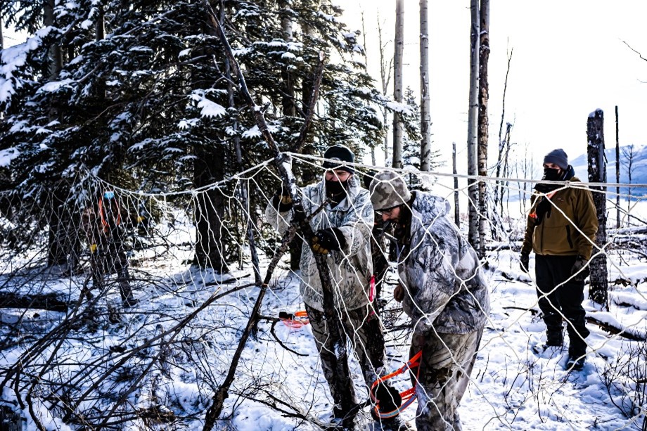
But the team decided to try a novel approach to capture and collaring, and used a method called “drive netting”. To the project team’s knowledge, this project is the only time the drive netting method has been used in BC since it was last used in the previous study on these same sheep (Wood et al. 2010). Essentially the team identified where the sheep congregate and then deployed approximately 100 – 150 meters of net about 6 feet high. Ten or more people stationed around the area spread out hanging the net in place while a helicopter cautiously moved the herd towards it. The sheep are caught in the net and that’s when the team can capture them for processing (health samples and collars). The team has found great success with this method, and it seems to cause less stress for the animal as the overall disturbance or impact time is shorter than with other more traditional methods.

Drive Netting (photo by Daniel Mclaren of Northern Conservation)

At the time of capture, the team collected health samples, and laboratory results indicated that all sheep captured in 2020 were negative for five viral and bacterial pathogens commonly carried by domestic ruminants, including MOVI. One ewe captured in 2021 tested positive for parainfluenza virus-3. When this virus was found previously in Dall’s sheep, it was not associated with the death of the animal, but it can lead to mortality in Bighorn sheep. More research is required to assess the effects of this virus on Stone’s sheep as data is limited.

Then the team stumbled upon something in their 2021 spring ground surveys that worried them: two ewes in the Dunlevy range had died during lambing season due to complications associated with giving birth; something that is considered very rare among Thinhorn sheep. The team is still waiting on results to determine the cause of this.

In 2020 and 2021 lamb surveys were conducted in summer, winter, and spring utilizing both ground telemetry and aerial telemetry methods to obtain better overall confirmation of lambs, but also to compare the two methods. It was found that ground telemetry methods were the least disruptive and provided the best information for lamb at heel. Aside from the rare occurrences mentioned above, lamb numbers are looking strong for the Dunlevy herd. As for the Schooler herd, it was hard to draw conclusions with such limited data, but one lamb was observed there.

Given that this type of data has not been collected in approximately 15 years, some unexpected results also arose to shed further light on the health conditions of the herds. Fecal samples indicated that the Williston sheep (part of the Dunlevy herd) had a significantly higher stress level than other herds measured in the Cassiar and Dome areas. This may be due to range overlap of the Williston sheep with elk herds, and the associated tick load and potential resource competition (something that has been found in previous studies). More research is required to assess the effects of range overlap with other wildlife herds such as elk, and overall stress levels of the wild sheep herds.

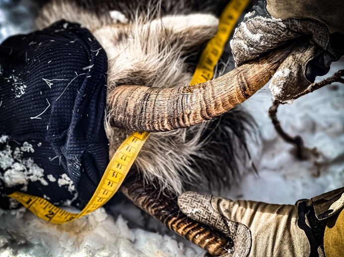
Horn Measurement (photo by Daniel Mclaren of Northern Conservation)

Population estimates indicated that while the Dunlevy herd was within normal population levels, the Schooler herd may have undergone significant declines. Only 8 individuals at one time have been observed. The team hopes that with four collared individuals in the Schooler herd, and more planned, as well as upcoming population surveys, more can be learned about their range possibly leading to additional groups of sheep being located.

Lastly, the team looked at a condition known as “lumpy jaw”, which is prevalent in North American wild sheep and is most common in Stone’s sheep. It is caused by the consumption of sharp forage items, especially needles, which become lodged in the gums. This often leads to bacterial infection and inflammation of the mouth resulting in bony proliferations; however, studies indicate that lumpy jaw does not seem to have any serious effects on the life expectancy or overall health of the sheep. Given that there is limited information on the effects of lumpy jaw on wild sheep, in all future mortality investigations the team will be collecting and examining mandibles for deformities and abnormal tooth wear that may be indicators of lumpy jaw.

Crews are keen to return to the field for surveys this spring to continue to gather data from Stone’s sheep herds to better understand this rare species, and in turn, better manage the herds and their habitat for generations to come.

The Stone Sheep Capture Team (photo by Daniel Mclaren of Northern Conservation)

We are thankful for the First Nations Support from Saulteau First Nation, Moberly Lake First Nation, Mcleod Lake Indian Band and Halfway River First Nations.

Funding Partners for this project include the Fish and Wildlife Compensation Program, Wild Sheep Society of BC, Wild Sheep Foundation, Northeastern B.C. Wildlife Fund, North Peace Rod and Gun Club, and MFLRORD services.