Tue, 11 Aug 2020

Habitat restoration across the Klinse-Za caribou herd range

HCTF’s Caribou Habitat Restoration Fund (CHRF) provides funding for restoration of critical habitat for BC’s caribou herds. This includes multiple projects designed to benefit the Klinse-za herd led by the Nîkanêse Wah tzee Stewardship Society, a joint initiative of the West Moberly and Saulteau First Nations. The Society is working in partnership with a team from Wildlife Infometrics to restore disturbed habitat. Wildlife Infometrics recently shared the following update focused on the monitoring component of this work.

Why restore?

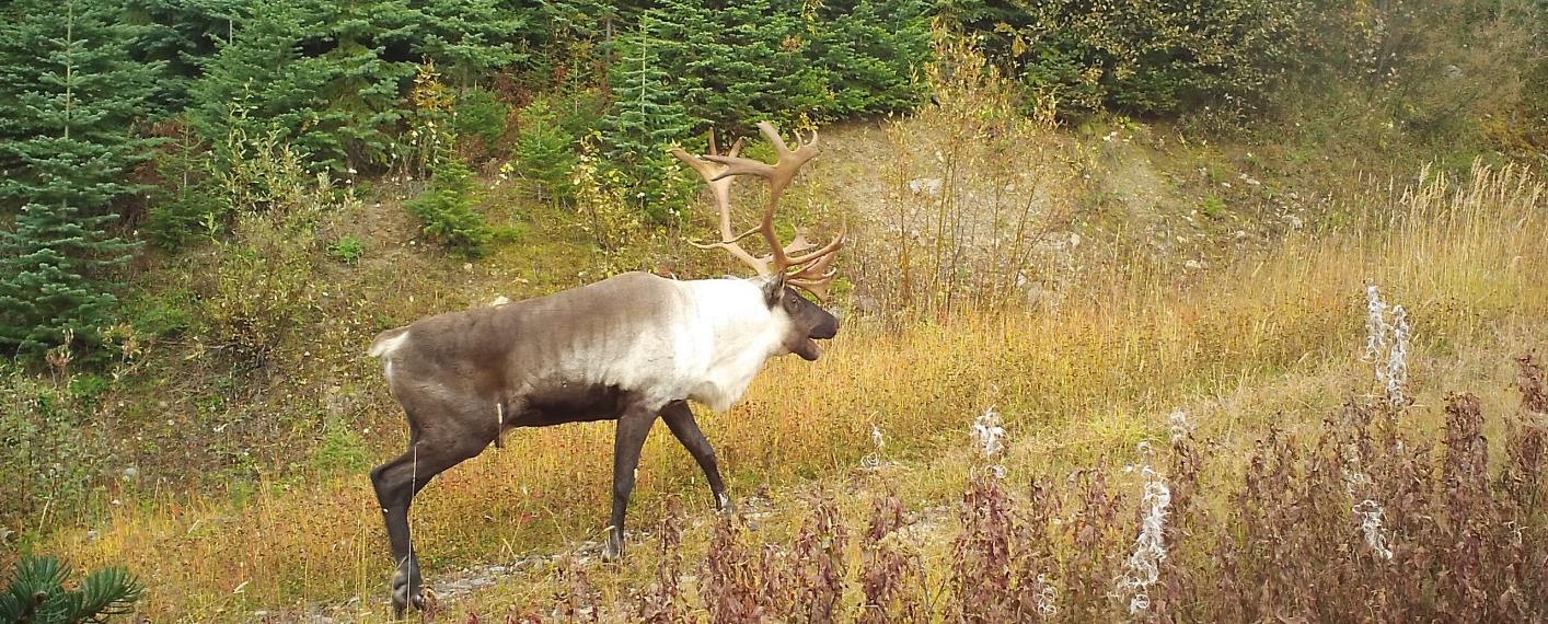
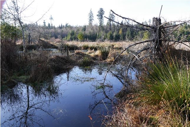
The Klinse-Za herd area, located between Mackenzie, Chetwynd and the Peace Arm of Williston reservoir, used to support a herd of almost 200 caribou as recently as 1995 and was said to be so numerous in historic times as be “like bugs on the land”. However, the herd has declined to under 40 individuals by 2013. Across BC, many caribou herds have experienced the same steep declines, and most of the struggling herds are inhabiting areas with generally more human disturbance and activity on the landscape. Specifically, industrial development has contributed to caribou declines as their habitat has been altered, displacing the caribou and making them more susceptible to predation. Since 2013, costly and intensive management efforts including maternity penning and predator removal have helped halt or reduce the rate of decline in some herds. However, these activities are not going to keep caribou on the land base over the long term. To improve caribou habitat, support the ecosystem and balance the predator-prey dynamics, we are implementing a large-scale habitat restoration project in the Klinse-za caribou herd area.

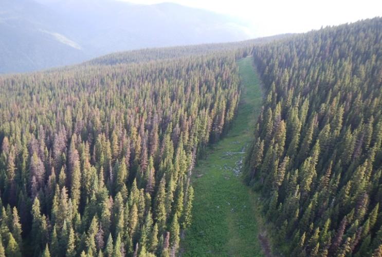
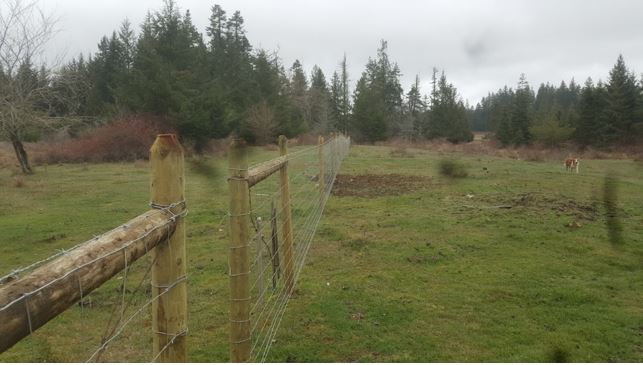
A road from low to high elevation provides an easy travel corridor for predators to access alpine refugia for caribou.

Restoration of habitat can involve a variety of activities. In the Klinse-za habitat restoration program, we focus our efforts on reforesting and restructuring linear features (e.g., old roads, seismic lines). This will limit the ability of predators to easily access caribou habitat and minimize caribou- predator interactions. Over time, reforesting the features will return the ecosystem to a more natural state.

Why monitor?

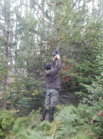
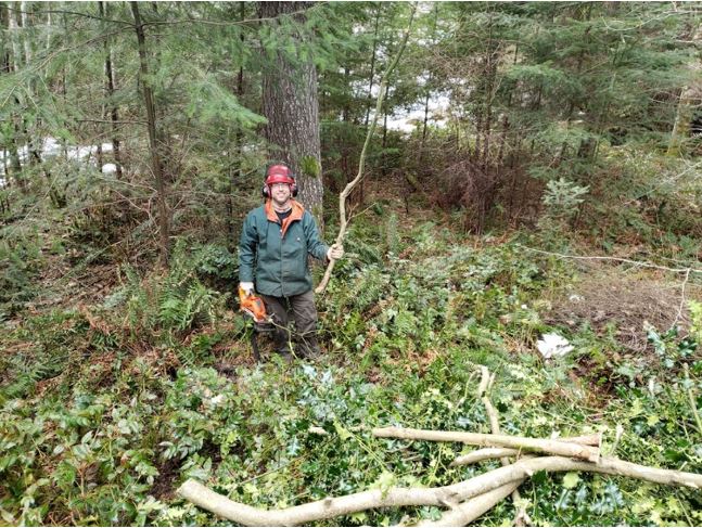
Crew member installing trail camera over an old road.

Our restoration project has two components, both equally important to the long-term success and usefulness of this endeavor. The ‘implementation’ piece is where features on the landscape actually change the way they look, appear to wildlife, or function within the ecosystem. These are the actions that include road structure modifications, tree planting, access alterations and other physical changes. To evaluate how much of a difference these changes made and how caribou and other wildlife are responding to them, we have a detailed monitoring program of data collection and analysis. It’s the monitoring that allows us to understand whether we’re meeting our objectives and make improvements to our plans if necessary.

Currently, our monitoring program has two main components: measuring changes in vegetation in response to restoration of linear features, and tracking wildlife and human road users through a network of trail cameras.

Trail camera discoveries

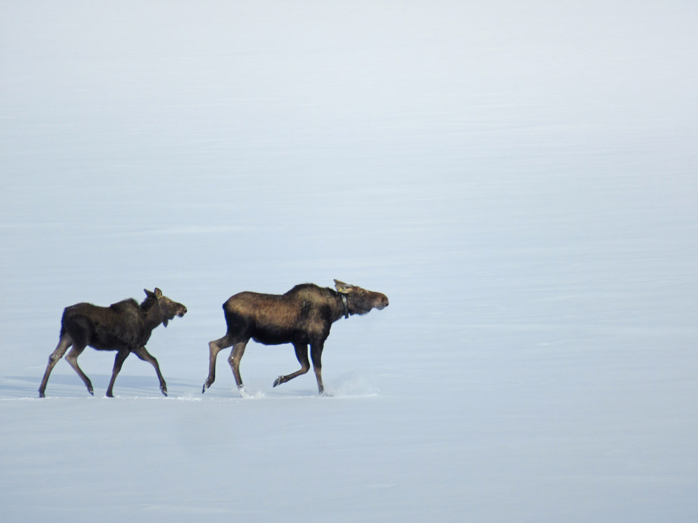
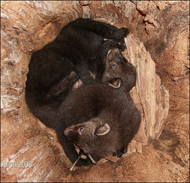
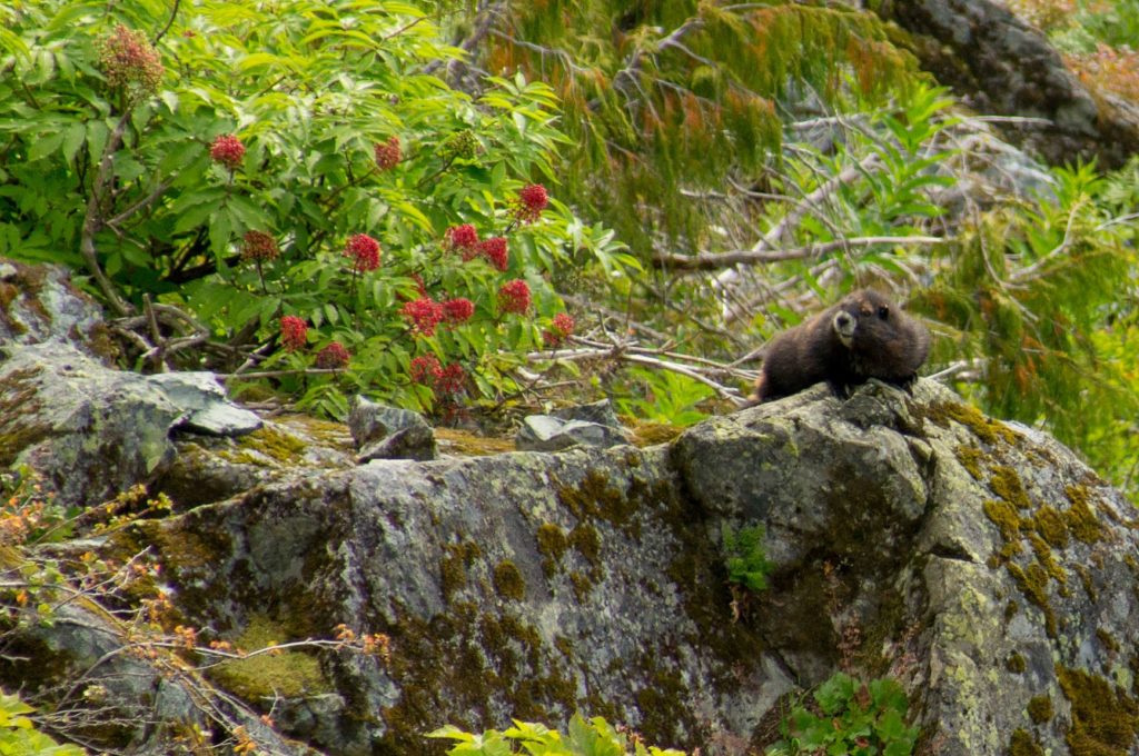
Motion activated trail cameras allow us to ‘have eyes’ across very large spatial extents, at all hours of the day and night. Since we currently have 200 cameras deployed across 7 different sites, we are monitoring a total of about 50 km of linear features. This large scale has allowed us to capture some interesting, valuable and sometimes surprising footage of the four-legged residents of our project area. One of the most vivid observations to date has been the large number of grizzly bears across the area – we have observed many sows with 2 to 3 cubs in tow, large males and several bears having a good scratch on trees, though our favourite picture remains a beautiful sunset image of a sow walking down the road with her three cubs!

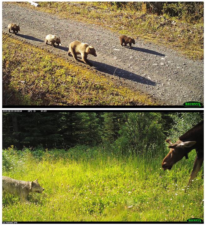
Above: a grizzly sow walking down the road with her three cubs. Below: a tense face-off between wolf and moose – we don’t know what the outcome was.

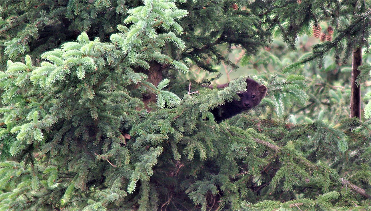
We have also observed a wide suite of other predators, including black bears, wolves, cougars, lynx, coyotes, wolverines, and more. While we are hoping to reduce predator access into alpine areas, it is nonetheless interesting to see such a diversity of predators in one area. We also see ungulates making extensive use of the linear feature, with moose being most abundant. Caribou and elk are both seen periodically.

Vegetation sampling: getting into the weeds

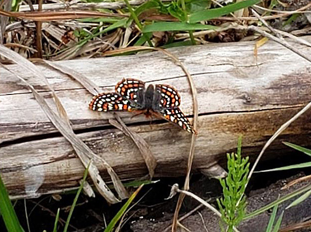
Tracking vegetation is important for two reasons. First, plants are essential as they form the basis of the food chain: vegetation provides energy to herbivores (large and small), who in turn support a variety of predators. Second, plants are highly responsive to environmental conditions such as moisture, shade, and soil type, and can thus be effectively used as indicators of habitat change. Since our goal with restoration is to alter existing linear disturbances so that they more closely resemble the surrounding habitat, we use a ‘before-and-after’ vegetation sampling approach. Specifically, we are collecting data about the plants on and near the linear features now (the ‘before’), and will collect the same data at intervals from one to ten years after we carry out the restoration activities, so that we can evaluate whether the restoration has been effective.

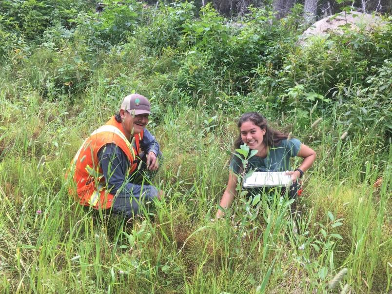
Crew members Warren Desjarlais and Mariah Mueller identifying
plant species.

While spending long field days identifying and counting plants can be a little hard on the back and somewhat repetitive, there are many delights in this work for the ‘plant nerds’ on the project. Identifying rare species or unusual color variants keeps us on our toes and sometimes requires impromptu group debates right on the mountain. Because the sampling sites are spaced hundreds of meters apart, we get to hike through a variety of elevations and ecotypes and see beautiful country. Finally, this kind of intensive field sampling provides valuable real- world training opportunities in plant identification, and so we include First Nations community members and/or summer students on our crews to help them develop their expertise and confidence.

Thanks again to Wildlife Infometrics on behalf of the Nîkanêse Wah tzee Stewardship Society for providing this update on their work!

Fri, 4 Oct 2019

Conservation Property Dedicated to Lifetime Conservationist Ron Taylor

The Southern Interior Land Trust (SILT) recently added a fifth property to its conservation holdings—a gem of intact streamside water birch habitat on the banks of Keremeos Creek near Olalla.

On Saturday, September 28th, SILT dedicated it the “R.E. Taylor Conservation Property” to honour Ron Taylor of Winfield, BC, in recognition of Ron’s life-long commitment to wildlife conservation. A career teacher and avid outdoorsman, Ron has influenced and mentored hundreds of young and old hunters, fishers, trappers, biologists and conservationists. Ron, through his strong conservation ethic, has always spoken on behalf of fish and wildlife and for the wise use of wild spaces.

Ron helped to create SILT, a non-profit land trust, and has served on its Board of Directors since the society was formed in 1988. He has been an active member of the Oceola Fish and Game Club for decades and has also served on its executive and that of the BC Wildlife Federation. Ron spent years advocating for a balance of natural resource use and protection at the Okanagan-Shuswap Land and Resource Management planning table. He has also served for several years on the Board of the Habitat Conservation Trust Foundation. Ron’s willingness to share his time and knowledge to so many fish and wildlife related endeavours has had positive and lasting impacts on natural resource management in BC.

Situated on flat valley bottomland, the R.E. Taylor Conservation Property provides habitat for at least six federally listed species at risk including yellow-breasted chat, western screech owl, Lewis’s woodpecker, barn owl, badger and common nighthawk. Deer, bear, moose, bobcat and other wildlife also use the property and rainbow trout and other fish live in the creek.

SILT works to keep its properties open to all types of wildlife-related recreation. SILT believes that doing so rewards the people that contribute to habitat conservation. Partial funding to purchase the R.E. Taylor Conservation Property came from the Habitat Conservation Trust Foundation. SILT appreciates the hunters, trappers, guides and anglers that support the foundation through their licence fees, and SILT’s other donors that help make our habitat acquisitions possible—for all living things.


Contributed by Al Peatt of the Southern Interior Land Trust

Tue, 24 Sep 2019
Tags: Wildlife

Study examines how wolves use their territory and their impact on moose

The Habitat Conservation Trust Foundation (HCTF) is supporting a number of studies to inform management decisions responding to the declining moose population in north-central British Columbia. One is looking at the many ways wolves use their home territory, and how this can impact moose.

HCTF has contributed close to $250,000 for the first three years of the study by the B.C. Ministry of Forests, Lands, Natural Resource Operations and Rural Development that is using satellite collars to track up to 10 wolf packs to examine the seasonal wolf predation risk to moose in two areas near Prince George and Fort St. James.

HCTF board member Al Gorley, who wrote a report for the ministry in 2016 recommending ways to restore moose populations in the province, welcomes the work. “While we need to apply the best management tools on the ground, it’s just as important to address critical information gaps,” he says. “This includes making sure we have scientifically appropriate and technically sound data about the complex and dynamic relationships between moose and predators such as wolves.”

Wildlife biologist Morgan Anderson, who is leading the research project for the ministry, agrees. “Where there’s food, there are wolves,” she says. “But it’s not that simple.” Wolves have large home territories – those in the study areas range from around 250 km2 to more than 900 km2 – but they do not use the whole territory in the same way. There are places on an active wolf territory where moose may never encounter a wolf.

“If we can figure out how wolves function over the entire landscape, we can determine what makes an area riskier for moose,” Morgan says. For example, if wolves avoid a road, maybe because of high volumes of industrial traffic, the area may be safer for moose – at least from a wolf predation standpoint. If the road improves access and moose are more likely to encounter a wolf, it would be riskier.

“Wolf responses to these features can inform our next steps for improving the landscape for moose – there may be ways to rehabilitate roads or configure harvesting to create places where moose can be more resilient to predators,” says Morgan.

It’s also important to understand population dynamics. One pack of 10 wolves can be extremely efficient, consuming a large adult moose completely and losing very little to scavengers. If the breeding male or female is killed and the pack splinters, the smaller packs are not as effective defending their kills from scavengers, forcing them to kill more prey.

The project is in its third year, and so far 17 wolves have been fitted with radio collars, although some have died or dispersed. In most cases, the animals are tracked by helicopter in the winter and darted. In the summer, rubber-padded leg-hold traps are used to capture wolves. Additional collars will be deployed this year to maintain collars on about five packs in each of the study areas, and to make up for wolves that die or disperse.

The satellite collars, which record hourly location fixes and upload this data every couple of days, are programmed to last two years and automatically drop off. The research team uses these locations with other spatial layers in GIS to identify the kind of landscape across the home territory and pinpoint where the wolves spend their time.

“We run a clustering algorithm that sorts the locations into groups, which we can visit on the ground,” says Morgan. “A larger cluster of 15 to 20 hourly locations within 100 metres suggests that they are on the kill of a large ungulate, so it’s a priority to visit it to identify the prey and collect samples.” As backup, some animals in the packs are equipped with VHF collars, which tend to have more reliable radio signals and battery life for relocating a pack if the satellite-collared wolf goes missing. They do not provide location data.

Moose cow kill site

Even though the wolves are pretty efficient – they often carry off and eat even the largest bones – it is still easy to find kill sites and identify the type of prey and its age. “We try to get out at least once a week. It’s not as easy in the winter when sites are covered with snow – you can be standing on top of it and not know. So we make this it priority to get to these sites in the spring.”

Morgan has worked with wolves before. She earned her Masters’ degree studying moose and wolf dynamics in Ontario, and is involved in a project in Nunavut examining interactions among Arctic wolves, muskox and endangered Peary caribou. “It’s interesting how similar wolves are across their range – they are super adaptable and flexible, but a lot of the behaviour patterns are the same.”

She is confident that by the time the project in north-central B.C. ends in 2021 there will be plenty of data to develop a predation risk layer that can be built into moose enhancement activities.

“We already have enough to start sketching in the picture, and are getting to a point where we can actually say something with the data we have,” she says. “It’s confusing when the pack territories shift and collared animals disperse, but we have a ton of locations for the resource selection work, and over 100 kill sites already identified. Of course, the more you want to break it down by season and study area, the bigger the sample you need in order to say anything meaningful.”

One thing that has surprised Morgan is the number of times wolves have left their pack. “We collared one wolf in a large pack and from his size and behaviour, we assumed he was the breeding male. Then he made a big walk, and ended up in a completely new area. We were surprised to see him take off. The next winter, another large pack in a productive neighboring territory started to use the dispersed wolf’s territory. It doesn’t seem like the old pack was entirely trapped out, so what happened to them, and why did the other pack leave their territory to move in?”

In some cases, the lone wolves travel so far they leave the study area. “We keep an eye on them but don’t do kill site investigations,” Morgan says. “We do talk to other biologists in case it is useful to their projects to have a bonus wolf with a collar.”

That’s just one example of how researchers are working together to gather and share data. Morgan offers a tip of her hat to the HCTF for supporting projects that let her and her colleagues work together to collect information and compare interactions – the wolf work is directly linked to the Provincial Moose Research Project, both other projects in the region can also benefit from the data.

She’s also grateful for the support of resource users such as hunters and trappers who return collars if they harvest a collared wolf, and provide regular updates about what they are seeing out on the land.


Thu, 5 Sep 2019
Tags: Stewardship

Stewardship Tools to Help Forest Professionals Conserve Fisher Habitat

The elusive fisher. Photo: Rich Weir


By J. Scott Yaeger, MSc, RPBio with contributions from Rich Weir, MSc, RPBio

This article originally appeared in the September/October edition of BC Forest Professional Magazine (republished with permission).

Pungent vanilla. Two words that I wrote in my field notebook twenty-four years ago to describe the subtle aroma on my hands after handling my first fisher (Pekania pennanti). Even now, those two words bring back the vivid memory of the day I caught this beautiful and elusive predator to attach a radio transmitter as part of a research study to learn more about how fishers use their forested habitats.

This housecat-sized member of the weasel family is difficult to study because they’re rarely seen by people, even those who work daily within the forests they inhabit. In fact, there are fewer fishers (less than 2,8001) than grizzly bears (about 17,0002) in British Columbia — and grizzly bear sightings don’t happen all that often. You might never see a fisher, but you are soon likely to hear more about this species because they’re becoming rarer in British Columbia. Research indicates that in areas where habitat is modified faster than it can re-grow, the ability of these landscapes to be occupied by fishers is “gravely” affected.3

Forestry professionals may soon be under increasing pressure to incorporate this rare animal’s needs into their forest development plans since fishers have specific habitat requirements (see Fisher Habitat 101 below). Because fishers have an association with late-successional forests, they’re sometimes perceived to be at odds with forestry objectives. It is true that timber harvest can dramatically impact the ability of the forest landscape to support fishers. But it doesn’t have to!

With financial support from the Habitat Conservation Trust Foundation, the Forest Enhancement Society of British Columbia, and the Fish and Wildlife Compensation Program – Peace, the BC Fisher Habitat Working Group works closely with forest industry partners to develop stewardship tools meant to help forest professionals include fisher habitat essentials into their forest development. Using data from 25 years of on-the-ground research, these tools help identify fisher habitat and provide specific guidance to support forest management decision-making.

As an example, GIS planning tools are available throughout the range of fishers to help planning foresters evaluate fisher habitat condition surrounding a proposed cutblock and provide detailed retention target recommendations for site-planning considerations. At a smaller scale, being able to identify fisher habitat on-the-ground (a single reproductive den tree for example) is crucial to reduce longer-term impacts of harvest operations. To this end, fine-scale tools (such as photo guides) are available to identify specific fisher habitats for retention and even how to build important habitat features within cutblocks.

Fisher kits in a den. Fisher dens need to be a minimum of 30 cm in internal diameter. Photo credit: Inge-Jean Hansen

How can forest professionals, or anyone interested in fisher habitat, get their hands on these tools to help inform decisions regarding fisher habitat stewardship? Visit the BC Fisher Habitat and Forestry Web Module where job-specific tools are available for forest industry personnel form planners to feller-bunchers. There’s also a helpful six-minute video that provides an overview of what’s available.

These tools help make it easier for forest professionals to include fisher habitat considerations into forest development projects. For more info and to request support for your specific operational requirements or to schedule one of the free training sessions regularly offered to forestry operations throughout the range of fishers in BC, please get in touch with Scott Yaeger or Rich Weir.

With your help, we can build approaches that work for both forestry and fishers and curb the decline of this species in British Columbia. By adopting these voluntary measures, you may be able to reduce the risk of additional regulatory requirement if BC fishers were to become federally listed. Please take a few moments of your time to visit the website, try out our tools, and get in touch with your ideas on how we can help you incorporate fisher habitat needs into your operations.


Fisher Habitat 101Fishers require specific forested habitats from individual trees to landscapes to fulfill their life requisites — namely reproductive denning, resting, foraging, and movement habitats. A good fisher home range (25 to 50 km² for females and much larger for males), includes a balanced mixture of forest ages and conditions that supply overhead cover, ample hunting opportunities, and large structures scattered throughout.Large-diameter live trees that are old, rotting, and deformed provide secure denning and resting locations that fishers need to survive and reproduce. Fishers are the largest animal in British Columbia that requires a tree cavity for successful reproduction, and big cavities — with a minimum of 30 cm internal diameter — are needed to house a mother and her two or three kits (photo). The trees that meet these conditions are generally old (more than 100 years) and large (greater than 40 cm dbh).Foraging habitat for fishers can be found in a variety of forest stands, including young forests if security cover is present. Fishers also require movement habitat to safely travel between important areas within their home range and to access new areas when dispersing. Movement habitat is supplied by dense tree and shrub cover, which provides protection from above and vertical escape opportunities.

Fun Fisher Facts:

Uncharacteristic of their name, fish are not a regular prey item for fishers. Fishers will eat anything they can catch, but primarily prey on snowshoe hares, squirrels, birds, and mice.Fishers are one of very few predators that actively seek out and prey upon porcupine. While most animals avoid porcupines due to their quills, fishers are quick enough to avoid the quills, nipping the porcupine in the face, and keep at it until the porcupine succumbs.Fishers are able to rotate their hind legs 180 degrees and climb down trees headfirst (a useful skill when pursuing a squirrel!)


REFERENCES

  1. Weir, R. D. 2003. Status of the fisher in British Columbia. Ministry of Sustainable Resource Management, Conservation Data Centre, and Ministry of Water, Land and Air Protection, Biodiversity Branch, Wildlife Bulletin Number B-105. Victoria, British Columbia.
  2. Hamilton, A.N., D.C. Heard, and M.A. Austin. 2004. British Columbia Grizzly Bear (Ursus arctos) Population Estimate. B.C. Ministry of Water, Land and Air Protection, Victoria, BC. 7pp.
  3. Weir, R. D., and F. B. Corbould. 2010. Factors affecting landscape occupancy by fishers in north-central British Columbia. Journal of Wildlife Management 74:405-410.


Wed, 28 Aug 2019
Tags: Wildlife

HCTF staff members at the Haley Lake Ecological Reserve

HCTF Staff Members (from left: Karen Barry, Christina Waddle, Sarah Sproull, and Jade Neilson) posing at the top of the bowl of the Haley Lake Ecological Reserve.

This summer, HCTF staff members were invited to join a team of researchers from the Marmot Recovery Foundation at the Haley Lake Ecological Reserve in the Nanaimo Lakes District to observe Vancouver Island marmots (Marmota vancouverensis). The staff members were treated with good weather, great scenery, and many marmot sightings. Marmots Alan and Towhee put on quite the show by sun tanning on rocks, chasing each other, and even touching noses!

Marmot Recovery Foundation Executive Director Adam Taylor and Acting Field Coordinator Mike Lester guided the HCTF group across the steep terrain of the Haley bowl to locate the marmots through the use of telemetry and binocular glassing. Throughout the excursion, the staff learned about the physiological and ecological requirements to sustain the marmot population plus predation risks and other threats that marmots face. The Marmot Recovery Foundation is collecting important information to help us better understand these endangered mammals, but there is still a lot to learn.

With only an estimated 200 marmots remaining in the wild, the Vancouver Island Marmot is currently listed as Endangered under the federal Species At Risk Act (SARA) and by the Committee on the Status of Endangered Species (COSEWIC). They are one of the rarest mammals in the world.

Although work at the Haley Lake site is not directly funded by HCTF, the staff were able to see first-hand the various field methods used by the Marmot Recovery Foundation at more remote sites on the Island. HCTF has funded a multi-year program to assist the Marmot Recovery Foundation with their work in Strathcona Park. The grant has enabled the team to work towards restoring a self-sustaining population of marmots through the use of translocations, food enhancement, monitoring and potentially habitat restoration. Another important aspect of their program is engaging the public and encouraging people to report marmot sightings. If you see a marmot while in the backcountry, you can submit your observations to marmots@telus.net or 1-877-4MARMOT (1-877-462-7668). To learn more about the Vancouver Island Marmot and how to help, visit their website at https://marmots.org/

Marmot Alan* sun tanning on a rock. Photo Credit: Adam Taylor

*On August 15, we were saddened to learn about the passing of Alan. Alan was described to be quite the adventurous and nomadic marmot! To learn more about Alan and his incredible peripatetic life, please visit the Marmot Recovery Foundation blog.

Thu, 22 Aug 2019

Land Stewardship Grant Helps Protect Habitat on Denman Island

Denman Conservancy Association volunteer removing English Holly

BC Land Trusts own and protect 103,000[1] hectares of conservation lands in BC. Although securement of conservation lands is a critical first step, the work doesn’t end there because it is equally important to maintain and enhance the ecological values for which the property was protected. For many land trusts, finding funding to cover management costs can be difficult, particularly following fundraising campaigns to purchase the property. HCTF’s Land Stewardship Grant is one option for non-government organizations to access funding to cover management expenses on conservation lands.

For instance, the Denman Conservancy Association (DCA) received a Land Stewardship Grant from HCTF for $19,500 over three years to help with management costs on their Settlement Lands property. Located at the northern extent of the Coastal Douglas Fir (CDF) ecosystem, the Settlement Lands contain diverse habitats including wetlands, rocky outcrops, and mature second growth forest, which support a wide range of wildlife and habitats, including 14 wildlife species at risk.

Taylor’s Checkerspot Butterfly – courtesy of Erika Bland

Taylor’s Checkerspot Butterfly – courtesy of Erika Bland

One of these species at risk is the Taylor’s Checkerspot butterfly which is red-listed in BC, and listed as Endangered under the federal Species at Risk Act. Denman Island is the only known breeding location in Canada. Some of the funds were used for habitat enhancement, including planting larval host plants and pollinator nectar plants, as well as butterfly monitoring and planning to improve habitat in the future. Other activities HCTF funded at the property include invasive species removal, fencing, wetland monitoring, trail decommissioning and maintenance, and information signage.

Beaver dam area at Homestead Marsh – courtesy of John Millen

Beaver dam area at Homestead Marsh – courtesy of John Millen

“This funding was very important to ensure ecological values will be maintained and enhanced,” says Erika Bland, DCA Land Manger. “The fencing project in particular, which was carried out in collaboration with a neighbouring farmer, was critical to protecting the wetland on the property from cattle trespass.”

New fence to prevent cattle access

New fence to prevent cattle access.

The next funding intake for Land Stewardship Grants is now open, with an application deadline of October 16th. Visit our Land Stewardship Grant webpage for more information, including how to apply. This program was made possible through an endowment provided by the Province of British Columbia. This funding opportunity only comes once every three years, so don’t miss out!


[1] British Columbia NGO Conservation Areas Technical Working Group. 2017. BC NGO Conservation Areas Database – Fee Simple, Registerable Interests, and Unregisterable Interests (secured as of December 31, 2016). Digital data files. Last updated June 27, 2017.