Sun, 21 Feb 2021

Video: Chase Caribou Habitat Restoration Project

Caribou were once plentiful in BC, but now the majority of herds are at risk of extinction. Roads and corridors built for industrial development allow predators such as wolves easy access to the areas where caribou live. To help reduce caribou mortality, the Habitat Conservation Trust Foundation and the Province of BC are funding projects that make it more difficult for predators to use human-made corridors by piling woody debris and creating soil mounds at key junctions leading to caribou habitat. Trees are also planted to help return these areas to a more natural state. Many of these caribou habitat restoration projects are led by First Nations, including the Caribou Flats restoration project.

Caribou Flats roadway lies within the population boundary of the Chase caribou herd, part of the Southern Mountain population of Woodland caribou. This herd is listed as threatened on Schedule 1 of the Species At Risk Act (SARA). In 2018, Chu Cho Environmental identified several forest roads within chase caribou herd range boundary which had potential for habitat restoration. These roads were identified with input from forest licensees, caribou biologists familiar with this herd, and Tsay Keh Dene Nation. In 2019, Chu Cho Environmental and Tsay Keh Dene Nation undertook habitat restoration activities to restore the roadway at Caribou Flats. A combination of functional and ecological restoration techniques were used. Functional restoration involved access control, slash rollback, and tree felling and hinging across the roadway, to make the road less-suitable for predator travel and human use. The intent of the functional restoration was to reduce predator-prey interactions on the roadway. Ecological restoration involved soil ripping and decompaction of the road surface, and tree planting. The goal of tree planting was to accelerate the return of the area to a mature forest environment.

The project was completed in summer 2020 and the team at Chu Cho Environmental put together the following video to tell the story of the restoration process and how this work is contributing to conserving caribou in BC.


You can access the report for this project here.

Tue, 11 Aug 2020

Habitat restoration across the Klinse-Za caribou herd range

HCTF’s Caribou Habitat Restoration Fund (CHRF) provides funding for restoration of critical habitat for BC’s caribou herds. This includes multiple projects designed to benefit the Klinse-za herd led by the Nîkanêse Wah tzee Stewardship Society, a joint initiative of the West Moberly and Saulteau First Nations. The Society is working in partnership with a team from Wildlife Infometrics to restore disturbed habitat. Wildlife Infometrics recently shared the following update focused on the monitoring component of this work.

Why restore?

The Klinse-Za herd area, located between Mackenzie, Chetwynd and the Peace Arm of Williston reservoir, used to support a herd of almost 200 caribou as recently as 1995 and was said to be so numerous in historic times as be “like bugs on the land”. However, the herd has declined to under 40 individuals by 2013. Across BC, many caribou herds have experienced the same steep declines, and most of the struggling herds are inhabiting areas with generally more human disturbance and activity on the landscape. Specifically, industrial development has contributed to caribou declines as their habitat has been altered, displacing the caribou and making them more susceptible to predation. Since 2013, costly and intensive management efforts including maternity penning and predator removal have helped halt or reduce the rate of decline in some herds. However, these activities are not going to keep caribou on the land base over the long term. To improve caribou habitat, support the ecosystem and balance the predator-prey dynamics, we are implementing a large-scale habitat restoration project in the Klinse-za caribou herd area.

A road from low to high elevation provides an easy travel corridor for predators to access alpine refugia for caribou.

Restoration of habitat can involve a variety of activities. In the Klinse-za habitat restoration program, we focus our efforts on reforesting and restructuring linear features (e.g., old roads, seismic lines). This will limit the ability of predators to easily access caribou habitat and minimize caribou- predator interactions. Over time, reforesting the features will return the ecosystem to a more natural state.

Why monitor?

Crew member installing trail camera over an old road.

Our restoration project has two components, both equally important to the long-term success and usefulness of this endeavor. The ‘implementation’ piece is where features on the landscape actually change the way they look, appear to wildlife, or function within the ecosystem. These are the actions that include road structure modifications, tree planting, access alterations and other physical changes. To evaluate how much of a difference these changes made and how caribou and other wildlife are responding to them, we have a detailed monitoring program of data collection and analysis. It’s the monitoring that allows us to understand whether we’re meeting our objectives and make improvements to our plans if necessary.

Currently, our monitoring program has two main components: measuring changes in vegetation in response to restoration of linear features, and tracking wildlife and human road users through a network of trail cameras.

Trail camera discoveries

Motion activated trail cameras allow us to ‘have eyes’ across very large spatial extents, at all hours of the day and night. Since we currently have 200 cameras deployed across 7 different sites, we are monitoring a total of about 50 km of linear features. This large scale has allowed us to capture some interesting, valuable and sometimes surprising footage of the four-legged residents of our project area. One of the most vivid observations to date has been the large number of grizzly bears across the area – we have observed many sows with 2 to 3 cubs in tow, large males and several bears having a good scratch on trees, though our favourite picture remains a beautiful sunset image of a sow walking down the road with her three cubs!

Above: a grizzly sow walking down the road with her three cubs. Below: a tense face-off between wolf and moose – we don’t know what the outcome was.

We have also observed a wide suite of other predators, including black bears, wolves, cougars, lynx, coyotes, wolverines, and more. While we are hoping to reduce predator access into alpine areas, it is nonetheless interesting to see such a diversity of predators in one area. We also see ungulates making extensive use of the linear feature, with moose being most abundant. Caribou and elk are both seen periodically.

Vegetation sampling: getting into the weeds

Tracking vegetation is important for two reasons. First, plants are essential as they form the basis of the food chain: vegetation provides energy to herbivores (large and small), who in turn support a variety of predators. Second, plants are highly responsive to environmental conditions such as moisture, shade, and soil type, and can thus be effectively used as indicators of habitat change. Since our goal with restoration is to alter existing linear disturbances so that they more closely resemble the surrounding habitat, we use a ‘before-and-after’ vegetation sampling approach. Specifically, we are collecting data about the plants on and near the linear features now (the ‘before’), and will collect the same data at intervals from one to ten years after we carry out the restoration activities, so that we can evaluate whether the restoration has been effective.

Crew members Warren Desjarlais and Mariah Mueller identifying
plant species.

While spending long field days identifying and counting plants can be a little hard on the back and somewhat repetitive, there are many delights in this work for the ‘plant nerds’ on the project. Identifying rare species or unusual color variants keeps us on our toes and sometimes requires impromptu group debates right on the mountain. Because the sampling sites are spaced hundreds of meters apart, we get to hike through a variety of elevations and ecotypes and see beautiful country. Finally, this kind of intensive field sampling provides valuable real- world training opportunities in plant identification, and so we include First Nations community members and/or summer students on our crews to help them develop their expertise and confidence.

Thanks again to Wildlife Infometrics on behalf of the Nîkanêse Wah tzee Stewardship Society for providing this update on their work!

Fall Site Visits: Stewardship, Sheep and Salmonids

Staff visit to Salmon River Estuary Conservation Area; Jade Neilson, Karen Wipond, Tom Reid, Christina Waddle, Shawn Lukas (from left to right)

HCTF staff enjoyed some time out in the field this fall with visits to project sites around the province. Each year, HCTF undertakes project evaluations on a sample of projects to conduct a financial review, and to ensure conservation objectives are being met.

The first evaluation took place in September with the Nature Kids program, a Stewardship project which aims to engage children and their families with nature through hands-on learning, stewardship activities and citizen science projects. HCTF staff visited the program’s office in North Vancouver and one of the weekend events in Greater Victoria called “Hawkwatch”.

The Raptors live demonstration at Hawkwatch.

In October, staff travelled to the Kootenays and visited 2 project sites with Irene Teske, Wildlife Biologist with the Ministry of Forest, Lands, Natural Resource Operations and Rural Development (FLNR). Staff got a first-hand look at areas being treated to control invasive plants such as Yellow Hawkweed and St. John’s Wort at Bull River and Wigwam Flats, both conservation areas in the East Kootenay region. For this project, HCTF Special Permits (Wild Sheep) funding is being used to restore native grasslands to improve winter forage for Bighorn Sheep.

2008 photo of the Bull River bighorn herd. Beginning in 2009, wildlife managers noticed a rapid spread of yellow hawkweed and other invasive plant species in this herd’s winter range.

The next visit was to a very different landscape on the east coast of Vancouver Island. HCTF visited three sites funded under the Conservation Lands Operations and Management (O&M) Funding Program: S’amanu Wildlife Management Area (WMA), Nanaimo River Estuary Conservation Area, and the Salmon River Estuary Conservation Area. This program provides $550,000 annually to FLNR for O&M costs on ministry-administered conservation lands across the province including lands leased from the Nature Trust of BC. Funding for this program is provided primarily through endowment funds provided to HCTF from the Province of BC.

HCTF staff and the FLNR Conservation Lands Specialist Karen Wipond received a tour hosted by the West Coast Conservation Land Management Program (WCCLMP) staff Tom Reid and Shawn Lukas, demonstrating how HCTF O&M funding is being used to maintain conservation values at the selected properties.

At the S’amanu WMA, we viewed and discussed the restoration work and new interpretive signage at Ye’yumnuts, a sacred ancestral place of the Cowichan people. We also discussed invasive species management supporting species at risk on the site, and agricultural activities to enhance forage for wintering waterfowl.

After leaving S’amanu, we travelled north to the Nanaimo Estuary, the largest estuary on Vancouver Island, with riparian, marsh, and intertidal ecosystems including eelgrass beds, supporting thousands of over-wintering birds and juvenile salmonids. We viewed some restoration work in action while program staff and partners tested nets in the estuary to monitor juvenile salmonids in the coming spring. HCTF funding is also being used to develop improved elevation and vegetation mapping in the estuary which will help support management decisions and plan future restoration and enhancement projects.

Nanaimo Estuary including split rail fencing used to control access and direct visitors.

The third site we visited with WCCLMP staff was the Salmon River Estuary Conservation Area near the Village of Sayward. An HCTF Enhancement and Restoration Grant was used for habitat enhancement work for Roosevelt Elk and other species on the property purchased in 2015, the acquisition of which was also supported by HCTF. This restoration project included thinning the alder forest and planting to improve forage for Roosevelt elk, removing Scotch Broom and replanting with native species, and creating shallow wetland habitat with wood structures to improve habitat for amphibians.

Enhanced wetland habitat at the Salmon River Estuary Conservation Area.

HCTF staff appreciated the opportunity to see the great work funded across the province. The HCTF evaluation process provides an additional check and balance in addition to our rigorous proposal review process to ensure conservation objectives are realized and we see a positive difference for fish and wildlife and their habitats, as intended by our various contributors.

Tue, 24 Sep 2019
Tags: Wildlife

Study examines how wolves use their territory and their impact on moose

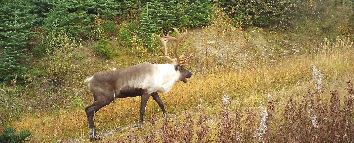
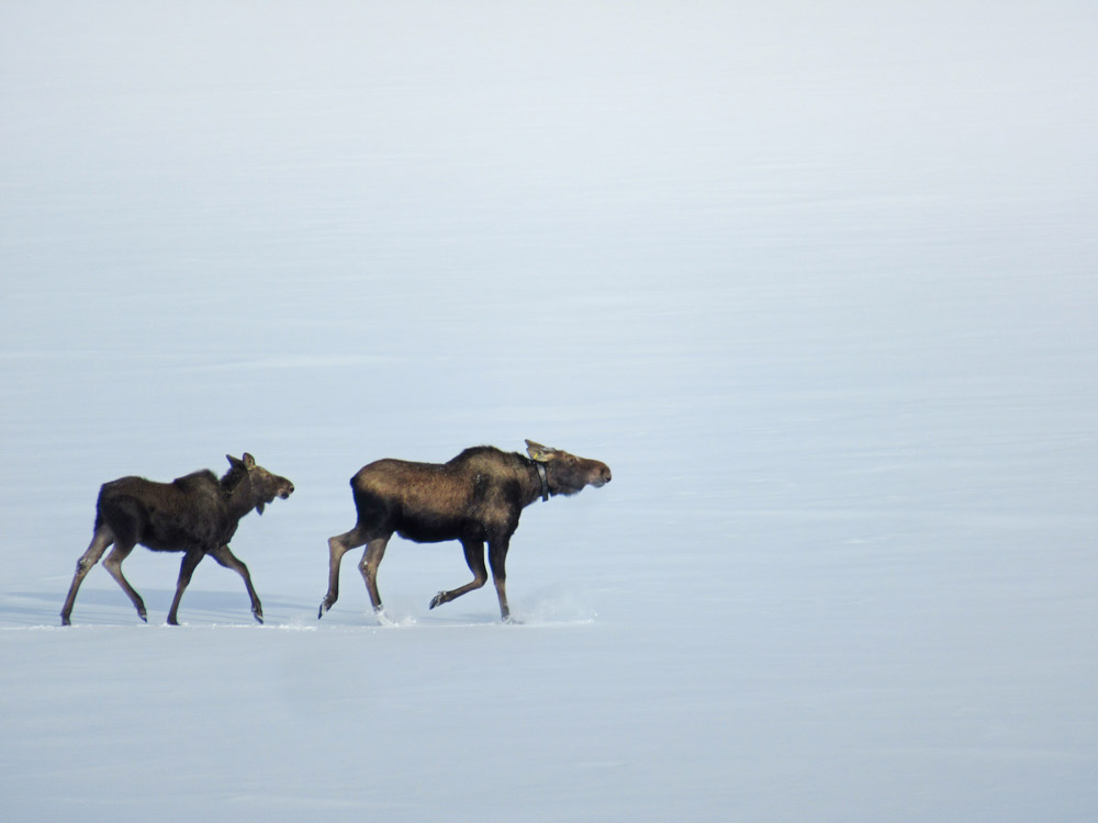
The Habitat Conservation Trust Foundation (HCTF) is supporting a number of studies to inform management decisions responding to the declining moose population in north-central British Columbia. One is looking at the many ways wolves use their home territory, and how this can impact moose.

HCTF has contributed close to $250,000 for the first three years of the study by the B.C. Ministry of Forests, Lands, Natural Resource Operations and Rural Development that is using satellite collars to track up to 10 wolf packs to examine the seasonal wolf predation risk to moose in two areas near Prince George and Fort St. James.

HCTF board member Al Gorley, who wrote a report for the ministry in 2016 recommending ways to restore moose populations in the province, welcomes the work. “While we need to apply the best management tools on the ground, it’s just as important to address critical information gaps,” he says. “This includes making sure we have scientifically appropriate and technically sound data about the complex and dynamic relationships between moose and predators such as wolves.”

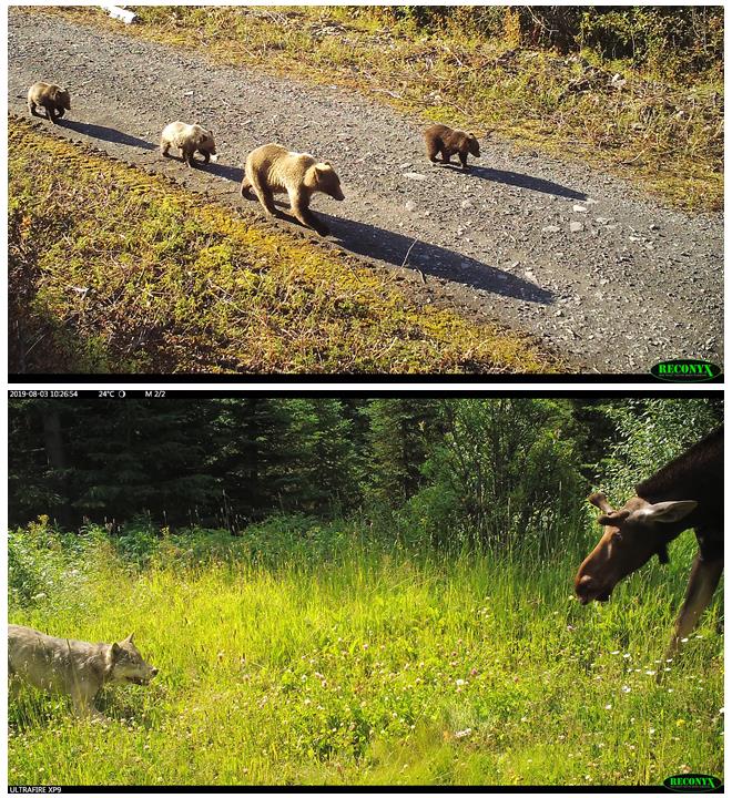
Wildlife biologist Morgan Anderson, who is leading the research project for the ministry, agrees. “Where there’s food, there are wolves,” she says. “But it’s not that simple.” Wolves have large home territories – those in the study areas range from around 250 km2 to more than 900 km2 – but they do not use the whole territory in the same way. There are places on an active wolf territory where moose may never encounter a wolf.

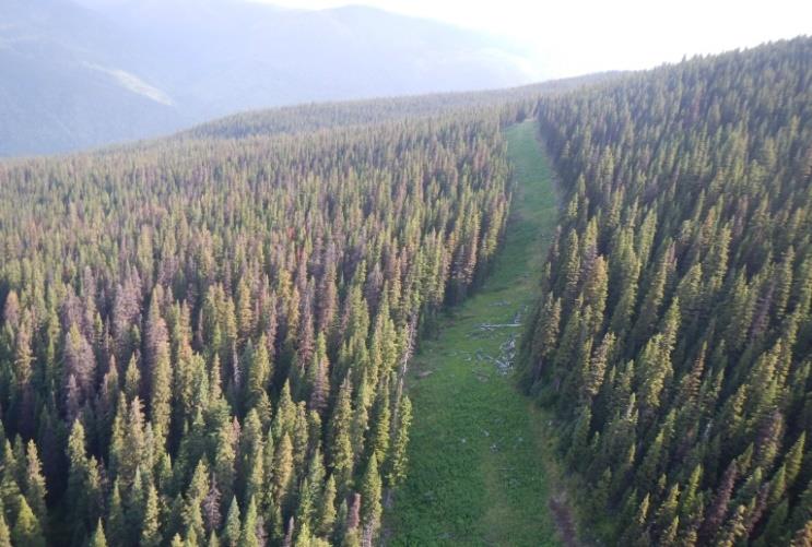
“If we can figure out how wolves function over the entire landscape, we can determine what makes an area riskier for moose,” Morgan says. For example, if wolves avoid a road, maybe because of high volumes of industrial traffic, the area may be safer for moose – at least from a wolf predation standpoint. If the road improves access and moose are more likely to encounter a wolf, it would be riskier.

“Wolf responses to these features can inform our next steps for improving the landscape for moose – there may be ways to rehabilitate roads or configure harvesting to create places where moose can be more resilient to predators,” says Morgan.

It’s also important to understand population dynamics. One pack of 10 wolves can be extremely efficient, consuming a large adult moose completely and losing very little to scavengers. If the breeding male or female is killed and the pack splinters, the smaller packs are not as effective defending their kills from scavengers, forcing them to kill more prey.

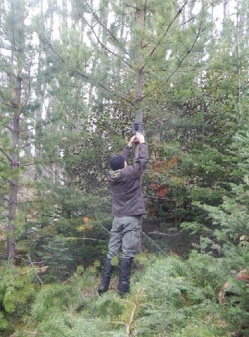
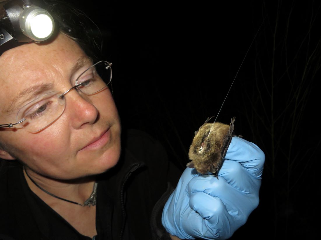
The project is in its third year, and so far 17 wolves have been fitted with radio collars, although some have died or dispersed. In most cases, the animals are tracked by helicopter in the winter and darted. In the summer, rubber-padded leg-hold traps are used to capture wolves. Additional collars will be deployed this year to maintain collars on about five packs in each of the study areas, and to make up for wolves that die or disperse.

The satellite collars, which record hourly location fixes and upload this data every couple of days, are programmed to last two years and automatically drop off. The research team uses these locations with other spatial layers in GIS to identify the kind of landscape across the home territory and pinpoint where the wolves spend their time.

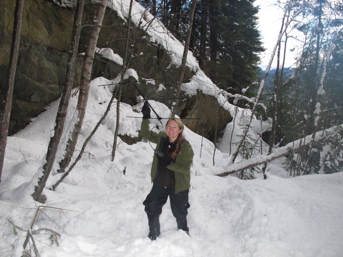
“We run a clustering algorithm that sorts the locations into groups, which we can visit on the ground,” says Morgan. “A larger cluster of 15 to 20 hourly locations within 100 metres suggests that they are on the kill of a large ungulate, so it’s a priority to visit it to identify the prey and collect samples.” As backup, some animals in the packs are equipped with VHF collars, which tend to have more reliable radio signals and battery life for relocating a pack if the satellite-collared wolf goes missing. They do not provide location data.
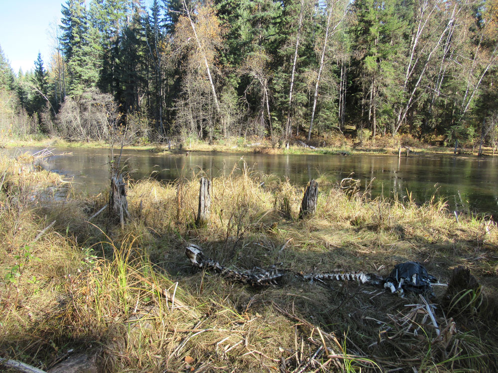
Moose cow kill site

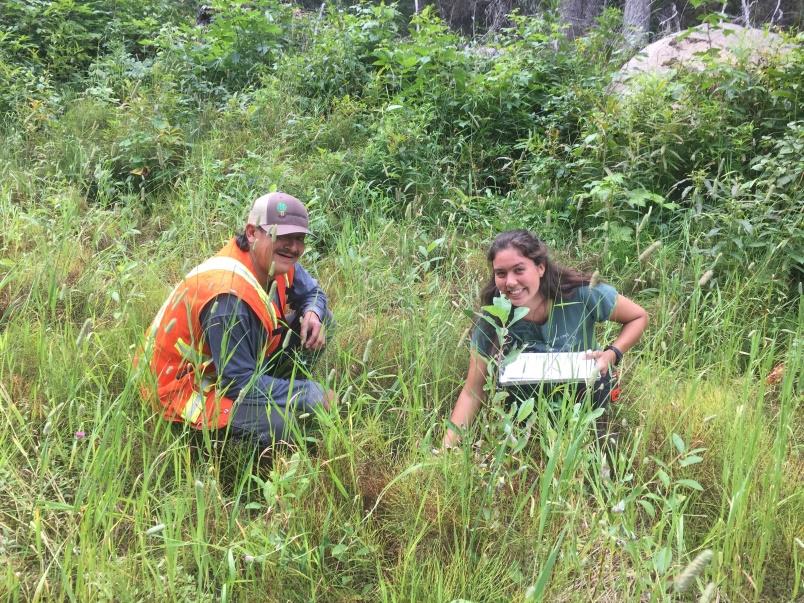
Even though the wolves are pretty efficient – they often carry off and eat even the largest bones – it is still easy to find kill sites and identify the type of prey and its age. “We try to get out at least once a week. It’s not as easy in the winter when sites are covered with snow – you can be standing on top of it and not know. So we make this it priority to get to these sites in the spring.”

Morgan has worked with wolves before. She earned her Masters’ degree studying moose and wolf dynamics in Ontario, and is involved in a project in Nunavut examining interactions among Arctic wolves, muskox and endangered Peary caribou. “It’s interesting how similar wolves are across their range – they are super adaptable and flexible, but a lot of the behaviour patterns are the same.”

She is confident that by the time the project in north-central B.C. ends in 2021 there will be plenty of data to develop a predation risk layer that can be built into moose enhancement activities.

“We already have enough to start sketching in the picture, and are getting to a point where we can actually say something with the data we have,” she says. “It’s confusing when the pack territories shift and collared animals disperse, but we have a ton of locations for the resource selection work, and over 100 kill sites already identified. Of course, the more you want to break it down by season and study area, the bigger the sample you need in order to say anything meaningful.”

One thing that has surprised Morgan is the number of times wolves have left their pack. “We collared one wolf in a large pack and from his size and behaviour, we assumed he was the breeding male. Then he made a big walk, and ended up in a completely new area. We were surprised to see him take off. The next winter, another large pack in a productive neighboring territory started to use the dispersed wolf’s territory. It doesn’t seem like the old pack was entirely trapped out, so what happened to them, and why did the other pack leave their territory to move in?”

In some cases, the lone wolves travel so far they leave the study area. “We keep an eye on them but don’t do kill site investigations,” Morgan says. “We do talk to other biologists in case it is useful to their projects to have a bonus wolf with a collar.”

That’s just one example of how researchers are working together to gather and share data. Morgan offers a tip of her hat to the HCTF for supporting projects that let her and her colleagues work together to collect information and compare interactions – the wolf work is directly linked to the Provincial Moose Research Project, both other projects in the region can also benefit from the data.

She’s also grateful for the support of resource users such as hunters and trappers who return collars if they harvest a collared wolf, and provide regular updates about what they are seeing out on the land.


Wed, 28 Aug 2019
Tags: Wildlife

HCTF staff members at the Haley Lake Ecological Reserve

HCTF Staff Members (from left: Karen Barry, Christina Waddle, Sarah Sproull, and Jade Neilson) posing at the top of the bowl of the Haley Lake Ecological Reserve.

This summer, HCTF staff members were invited to join a team of researchers from the Marmot Recovery Foundation at the Haley Lake Ecological Reserve in the Nanaimo Lakes District to observe Vancouver Island marmots (Marmota vancouverensis). The staff members were treated with good weather, great scenery, and many marmot sightings. Marmots Alan and Towhee put on quite the show by sun tanning on rocks, chasing each other, and even touching noses!

Marmot Recovery Foundation Executive Director Adam Taylor and Acting Field Coordinator Mike Lester guided the HCTF group across the steep terrain of the Haley bowl to locate the marmots through the use of telemetry and binocular glassing. Throughout the excursion, the staff learned about the physiological and ecological requirements to sustain the marmot population plus predation risks and other threats that marmots face. The Marmot Recovery Foundation is collecting important information to help us better understand these endangered mammals, but there is still a lot to learn.

With only an estimated 200 marmots remaining in the wild, the Vancouver Island Marmot is currently listed as Endangered under the federal Species At Risk Act (SARA) and by the Committee on the Status of Endangered Species (COSEWIC). They are one of the rarest mammals in the world.

Although work at the Haley Lake site is not directly funded by HCTF, the staff were able to see first-hand the various field methods used by the Marmot Recovery Foundation at more remote sites on the Island. HCTF has funded a multi-year program to assist the Marmot Recovery Foundation with their work in Strathcona Park. The grant has enabled the team to work towards restoring a self-sustaining population of marmots through the use of translocations, food enhancement, monitoring and potentially habitat restoration. Another important aspect of their program is engaging the public and encouraging people to report marmot sightings. If you see a marmot while in the backcountry, you can submit your observations to marmots@telus.net or 1-877-4MARMOT (1-877-462-7668). To learn more about the Vancouver Island Marmot and how to help, visit their website at https://marmots.org/

Marmot Alan* sun tanning on a rock. Photo Credit: Adam Taylor

*On August 15, we were saddened to learn about the passing of Alan. Alan was described to be quite the adventurous and nomadic marmot! To learn more about Alan and his incredible peripatetic life, please visit the Marmot Recovery Foundation blog.

Tue, 20 Aug 2019
Tags: F&W / Wildlife

Seeking ways to protect western bats from deadly white-nose syndrome

Cori Lausen glues a transmitter onto a bat in fall which will help locate roosts as well as provide valuable information about hibernation behaviours and physiology, needed to understand how white-nose syndrome may impact bats in BC.

The first time Cori Lausen held a big brown bat in her hands, it was love at first sight. “She was so tiny, she fit in my hand. And the band showed that she was older than I was.”

The more Cori learned about bats, the more she realized how unique they are – and when she asked questions about them there were often no answers. “There are so many things we just don’t know about them.”

So she took a leave of absence as a high school teacher in 1999, earned a Masters’ degree on bat ecology at the University of Calgary and a PhD in bat population genetics.

Today as associate conservation scientist with Wildlife Conservation Society Canada, Cori is looking for ways to protect western bat populations from deadly white-nose syndrome (WNS). This includes cutting-edge research supported by Habitat Conservation Trust Foundation (HCTF) to develop and apply a probiotic cocktail that can help bats survive the disease. HCTF has contributed nearly one fifth of the $583,000 budget for the two-year project.

WNS originated in Europe and is caused by the fungus Pseudogymnoascus destructans. It first appeared in North America in New York State in 2006, and has since killed millions of bats. “Many of us shed tears when we first heard of it,” Cori says. “We did not understand it, but knew its devastation was going to spread like wildfire.”

The disease started in the east and gradually moved south and north. Its spread west was slower because of migration patterns, until 2016 when it made a giant leap into Washington State. “The jump was a big shock,” says Cori. She expects the infected bat hitched a long-distance ride on a transport truck going to the port in Seattle, highlighting the importance of checking trailers, campers, and trucks for stowaway bats.

WNS causes a white fungal growth across a bat’s muzzle and wings, and has a death rate of up to 100 per cent. It disrupts winter hibernation, rousing the bats so they use up the valuable fat reserves they need to survive until spring.

There’s an added challenge in western North America because there are no large bat hibernacula like in the east. Instead, bats overwinter in smaller numbers in rock crevices, trees, caves and mines, and even in some buildings.

Cori was already interested in what bats in western Canada do in winter when WNS appeared in Washington State, and thanks to help from many BC naturalists, had detected eight of the 14 species that overwinter in British Columbia. “When the fungus first showed up, we realized that understanding where bats are is now more than curiosity – it is absolutely urgent.”


Cori Lausen tracks bats in winter in the West Kootenay region. Telemetry is used to locate hibernacula, as well as provide valuable information about hibernation behaviours and physiology, needed to understand how white-nose syndrome may impact bats in BC.

Cori Lausen tracks bats in winter in the West Kootenay region. Telemetry is used to locate hibernacula, as well as provide valuable information about hibernation behaviours and physiology, needed to understand how white-nose syndrome may impact bats in BC.

But with few locations and few bats, these winter hibernacula are unlikely to yield a solution to the WNS problem. “We need a ‘made in the west’ approach to fight off the fungus, and set them up to come back in the spring alive,” Cori says. “We decided to target our vulnerable building-roosting bats as we know where thousands of them roost in the summer.”

Through the HCTF project, the researchers developed a probiotic using bacteria sourced from local healthy bats. They first tested it on captive bats at the British Columbia Wildlife Park in Kamloops in 2018.

This spring, they developed an application method, and will test it in the Vancouver region where WNS will probably appear first in British Columbia. At roost entrances, they will dust powdered clay infused with the probiotic, so it sticks to the bats and they get a small dose every time they come and go.

“We are the first to propose treating bats in summer, introducing probiotic gradually so it does not overwhelm their immune system,” Cori says. “We will take wing swab samples from the bats now, and repeat in spring to see if the probiotic is still there and still viable.”

A California Myotis bat from Lillooet BC is wing-swabbed to look for bacteria that naturally prevent growth of Pd to use in the development of the probiotic cocktail. Photo by Ian Routley.

Purnima Govindarajulu, acting head of the B.C. Ministry of Environment and Climate Change Strategy’s Conservation Science Section, is part of an advisory committee supporting the project. “Bats are an important part of a healthy ecosystem,” she says. “White nose syndrome could have serious repercussions in British Columbia because bats eat huge number of insects, and this benefits agricultural crops, forests and people.”

British Columbia is better positioned than many other western regions thanks to BC Community Bat Programs (www.bcbats.ca/) that encourage individuals to identify roost sites and show landowners how to protect these sites or install bat-houses.

“We know white nose is coming so we have nothing to lose,” says Cori. “It does not cost a lot to give a landowner a little bag of clay that they can dust into bat boxes or building roosts. If it looks like it will save bats, we will apply for further research support to develop a widespread approach.”